The adventures and various works of a photographer, road tripper, former patron of the local arts, aspiring app developer, and late night coffee drinker and conversationalist.
New York-born photographer Arthur Rothstein made a name for himself with his many series of photos documenting America. His long career earned him recognition for his work as a photojournalist, author, and teacher, but it is perhaps his Great Depression era work, undertaken at the behest of the U.S. Farm Security Administration, for which he is best remembered today. In 1942, this assignment brought him to North Texas and to the old Fort Worth-Dallas Highway, where his photographer's eye led him to capture a string of period businesses and landmarks along the way. These images would become important historical records of their period in history, all of them eventually seeing reproduction on prints, postcards, and historical publications and websites time and time again in the decades since.
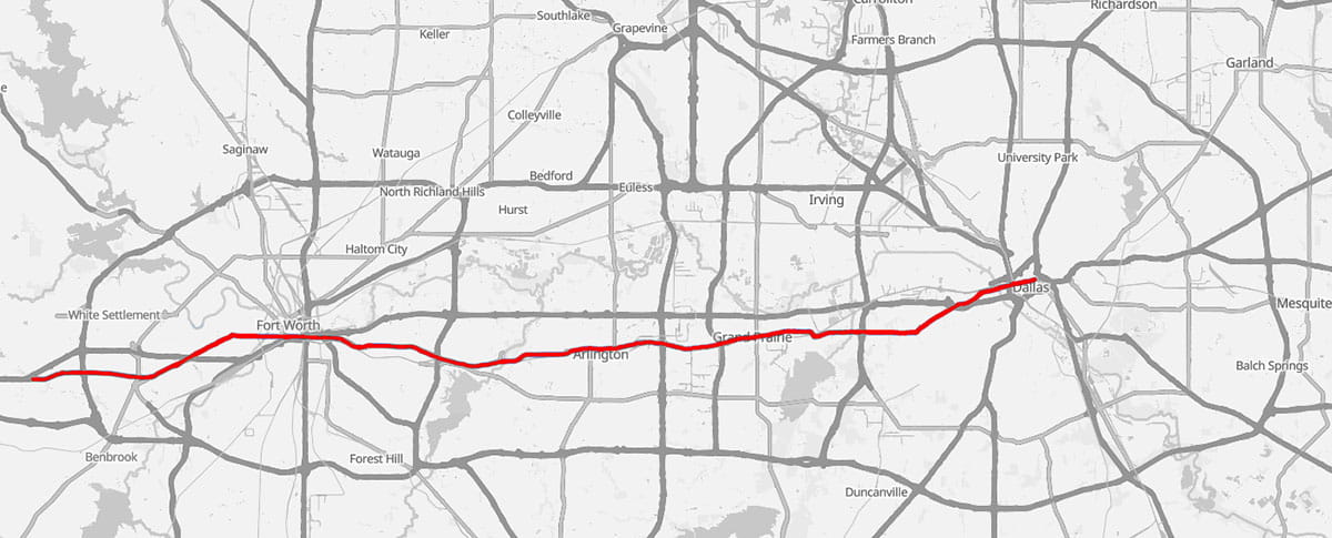
Now fast forward to 2025, when a part-time hobbyist blogger in Dallas has decided to revisit Rothstein's earlier route with a modern day digital camera. Over a period of a few months late in the year, I reconstructed a version of the original 1942 jaunt, having managed to identify twenty-two of Rothstein's original locations. These have been arranged into a single trip heading eastward across the DFW metroplex. So join me for a drive along the remains of the old Bankhead Highway, later the Fort Worth/Dallas Pike, traversing Lancaster, Division, Main, W. Davis, Fort Worth Avenue, and W. Commerce Streets, aka the former State Highway 1, former U.S. Hwy 80 and U.S. Hwy 80 Business, and current (partial) State Highway 180, from Fort Worth to Dallas, to see how things today compare to what existed eighty-four years ago.
Note: The exact routes that historically made up Hwy 80 west of Big Town Blvd. were slightly varied depending on the specific time period; for this tour, I'm tracing a route that connects the twenty-two locations being featured.
Route for the reconstructed drive
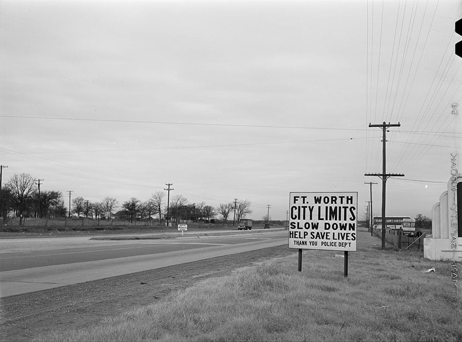
Facing east near the Fort Worth boundary line in 1942. The precise location of this original starting point is up for debate, as period maps, city directories, and other available sources provide contradictory information regarding the city's exact western terminus at the time of Rothstein's photo.
Boundary line between Fort Worth and Arlington, 1942
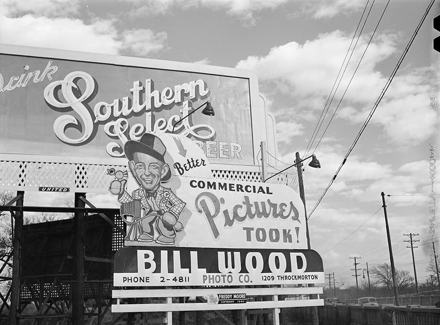
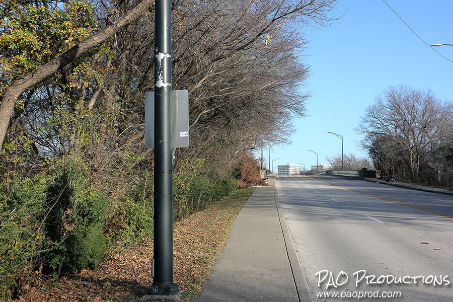
We pick up the trail west of downtown, where billboards promoting Southern Select beer and Bill Wood's Photo Co. flanked the W. Lancaster Avenue bridge over the Trinity River's Clear Fork.
Approaching the W. Lancaster Avenue bridge in 1942
The view at the West Lancaster Avenue bridge in late 2025.
Approaching the W. Lancaster Avenue bridge in late 2025
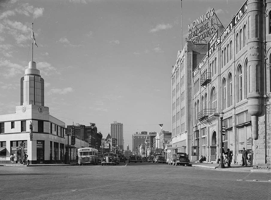
In 1942, decades before the construction of the Fort Worth Convention Center and the Fort Worth Water Gardens, Main Street directly connected the Tarrant County Court building with W. Lancaster Avenue.
Facing north on Main Street at Lancaster, 1942
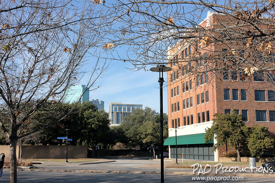
Today, the former Monnig Dry Goods building, now Water Gardens Place, stands as a reminder of what once existed in the former 1600 block of Main Street. The former Main Street route is now messily redirected around the Convention Center and Fort Worth Water Gardens via Houston and Commerce Streets, and via a fragment of East 15th.
Facing north from W. Lancaster Avenue, late 2025
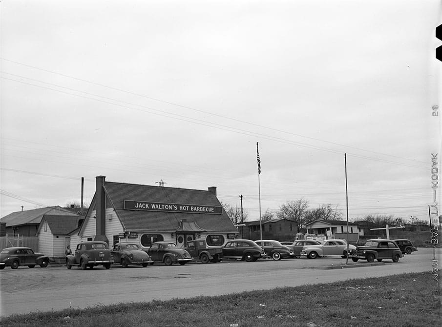
Jack Walton's Hot Barbecue stood at 1900 E. Lancaster Avenue for about two decades beginning around 1940. The building was engulfed by fire in January 1959 and ultimately sold in 1960 to Pete Vouras, becoming Pete Vouras' Barbecue Drive-In. It later became part of the Mr. Quick chain.
Jack Walton's Hot Barbecue, Fort Worth
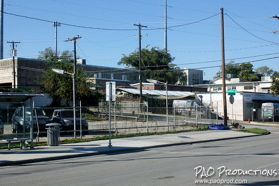
The 1900 block of E. Lancaster, as of late 2025, was the site of Cavenders Motors, situated at the southeast corner of Lancaster and Grafton.
1900 block of E. Lancaster Avenue, Fort Worth
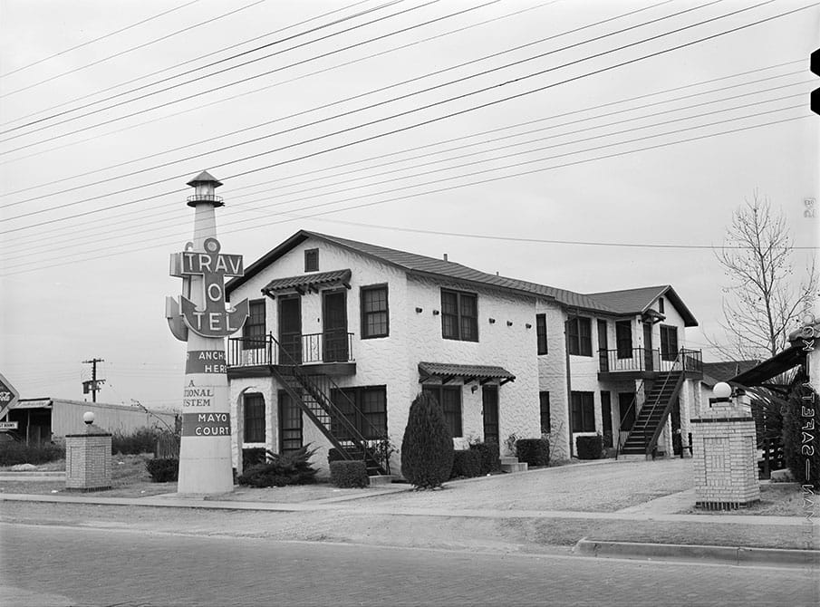
The Mayo Courts, located at 1917 E. Lancaster, offered forty-one units of "Modern and Cool Hotel Accommodations" to travelers motoring along the Dallas Pike.
The Mayo Court Trav-O-Tel, Fort Worth
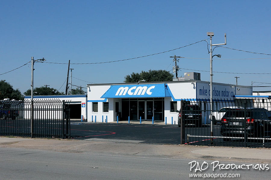
Today the Mike Carlson Motor Company building stands at 1917 E Lancaster Ave. on the other side of the highway from Cavenders Motors, one of eight such locations in the Fort Worth area.
1917 E. Lancaster Ave, Fort Worth
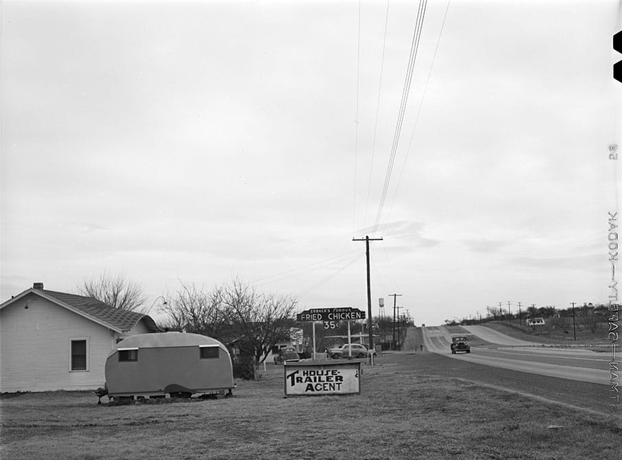
The Broadway Inn Tourist Courts were situated on the 5200 block of E. Lancaster, owned by H.J. Erback, also the proprietor of the eponymous Erback's Famous Fried Chicken. The entire complex was sold in 1943 due to a court judgment against Erback.
Erback's Famous Fried Chicken, Fort Worth
Today, 5200 E. Lancaster is the site of the Lancaster Apartments, an eighty-five unit complex on Fort Worth's near east side. The complex was formerly the Park Central Apartments, a one-time luxury facility that fell on very hard times by the 1990s.
5200 E. Lancaster Avenue, Fort Worth
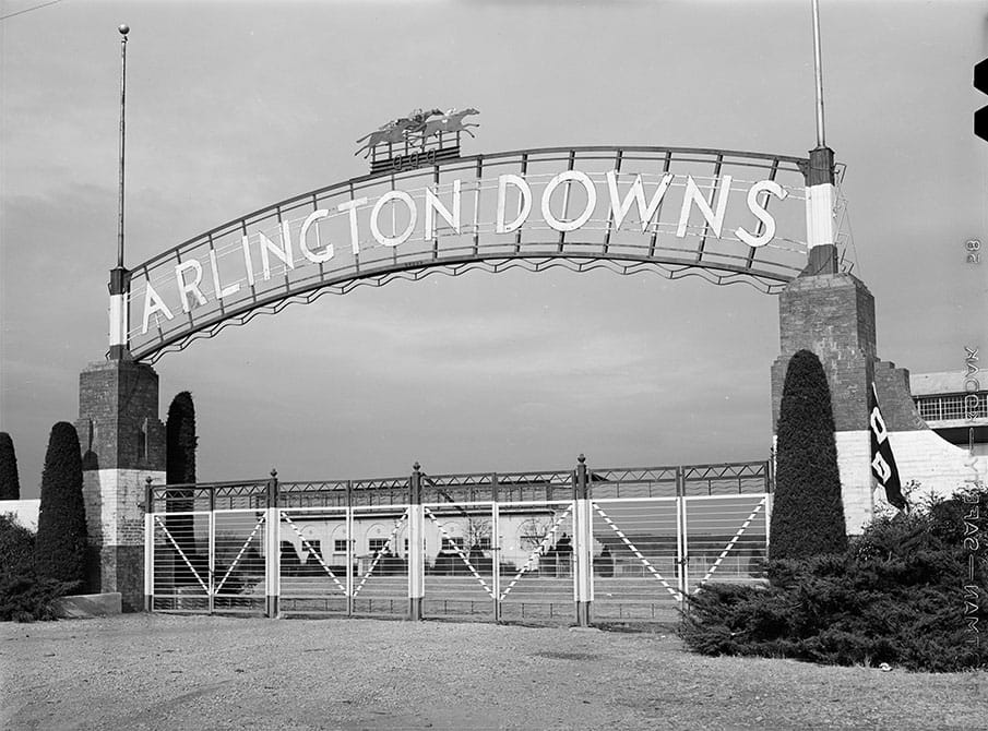
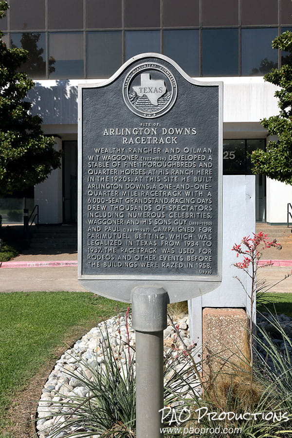
The Arlington Downs complex operated for nearly three decades from its opening in November 1929, functioning as a horse racetrack with legalized pari-mutuel betting from 1933 until 1937, and afterward as site for rodeos and events until its demolition in 1958. Prior to 1933, pari-mutuel betting was illegal, forcing the track to be utilized for non-betting purposes.
View of the Arlington Downs complex from the highway, 1942
In 1942 the racetrack extended to the highway, with an entrance just off the main route.
Entrance to the Arlington Downs racetrack
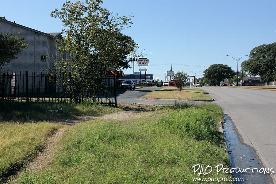
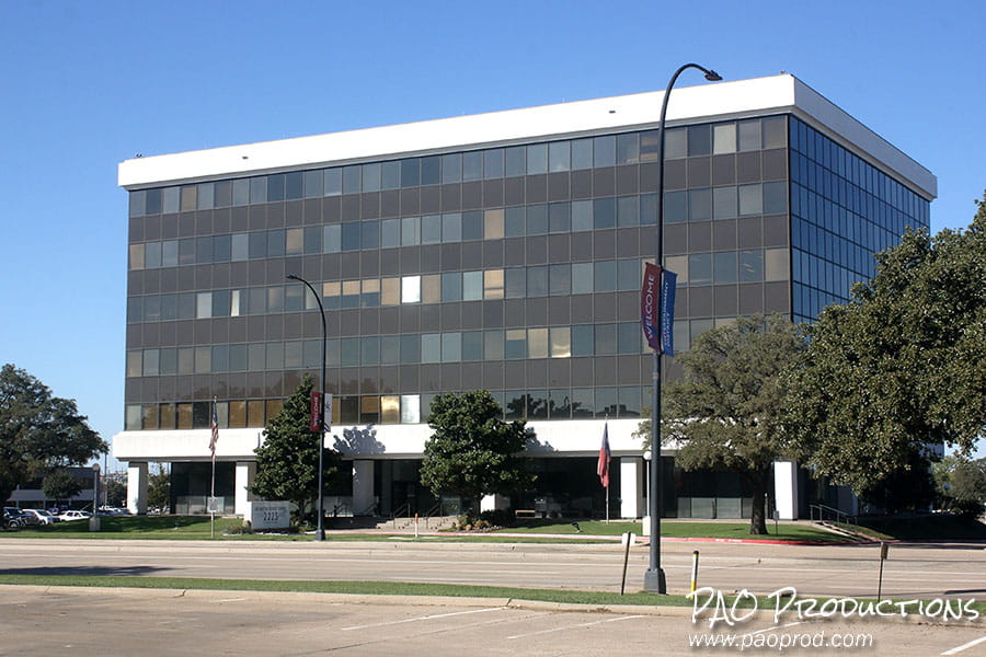
Today the former outer bounds of the complex are lined with commercial businesses and parking lots. Journey farther in, to present-day Randol Mill Road, and you'll find the Arlington Downs Tower, a six-story, 87,000 square foot office building named for the racetrack which once occupied the grounds. The location is now designated as a historic site.
Arlington Downs Tower, 2225 E. Randol Mill Rd., Arlington
Arlington Downs Racetrack historical marker
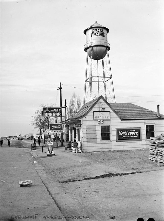
The Hangar restaurant in Grand Prairie appealed to workers from the North America Aviation plant some 2 1/2 miles away, providing a gathering place for those employed in support of the aircraft industry and war effort.
The Hangar restaurant, west of Hensley Field in Grand Prairie
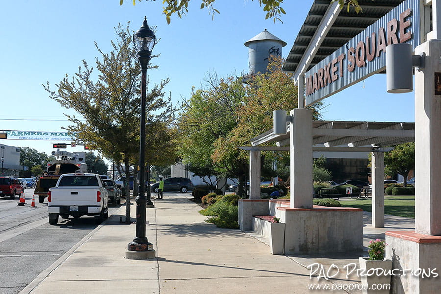
A view down the now considerably busier W. Main Street in Grand Prairie in late 2025. Present-day development in the area makes it difficult to replicate the original composition and angle.
Area near Market Square in Grand Prairie
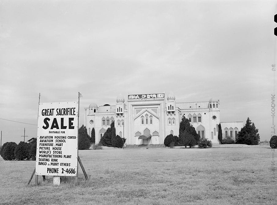
The Bagdad Supper Club, whose dance floor was billed as the largest in the Southwest, opened to the public on January 23, 1929 as a combination dining and entertainment hall. Constructed following an (alleged) Moorish motif and intended to project a Persian-style allure, the Bagdad was conceived not as a typical cabaret but rather as a destination for clubs, organizations, and families seeking a night of "high class" entertainment. The 7,000 square foot club was acquired in 1945 by Dr. Cosette Faust Newton and her husband, surgeon F.H. Newton; it was subsequently remodeled and re-imagined as a permanent museum for Mrs. Newton's collection of cultural items from across the world. Instead, the club went up in flames on April 19, 1953, destroying the collection and leading to an estimated loss of over one million dollars.
The Bagdad Supper Club at the corner of Main Street and N. Bagdad Rd in Grand Prairie
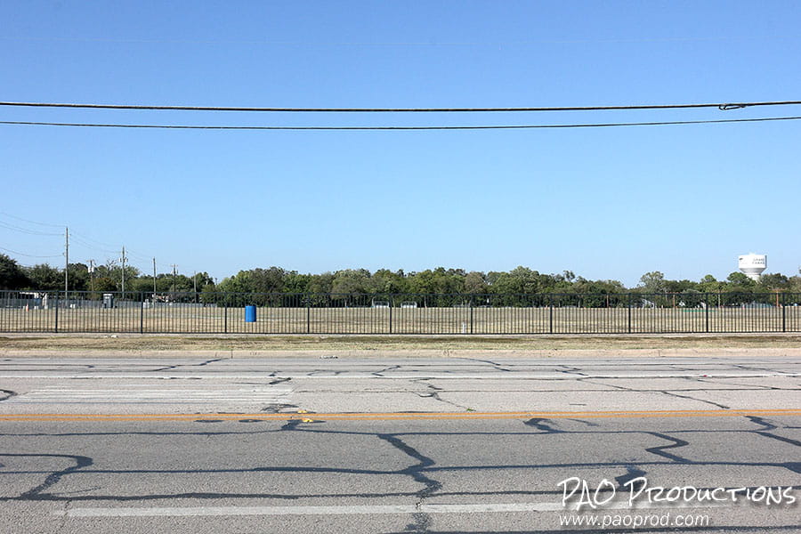
Today, the site that once hosted the Bagdad is now just an empty field.
Facing Prairie Park in Grand Prairie, late 2025
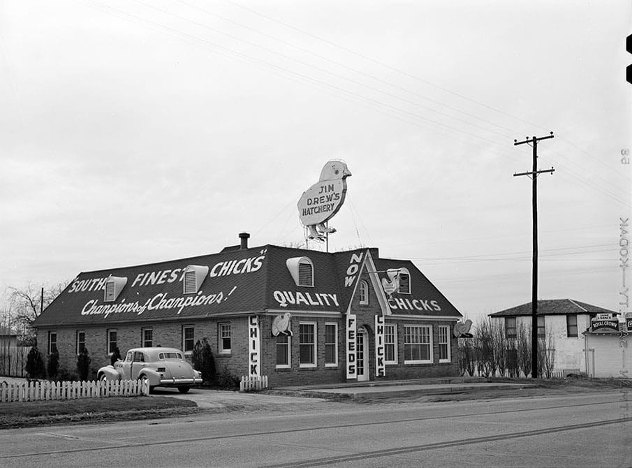
Jim Drew's Hatchery in Arcadia Park was a place to buy chicks, the "South's finest" according to contemporary advertisements. In late 1943, the year after this photo was taken, one hundred chicks retailed for $6.90.
Jim Drew's Hatchery at 5730 Fort Worth Pike in Dallas
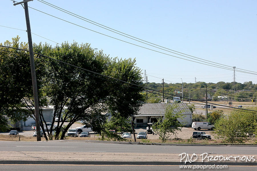
The westernmost route of Loop 12 crosses W. Davis Street near the original location of Jim Drew's Hatchery. The southeast corner of the intersection is now given over to industrial applications.
Near 5730 W. Davis Street in Dallas in 2025
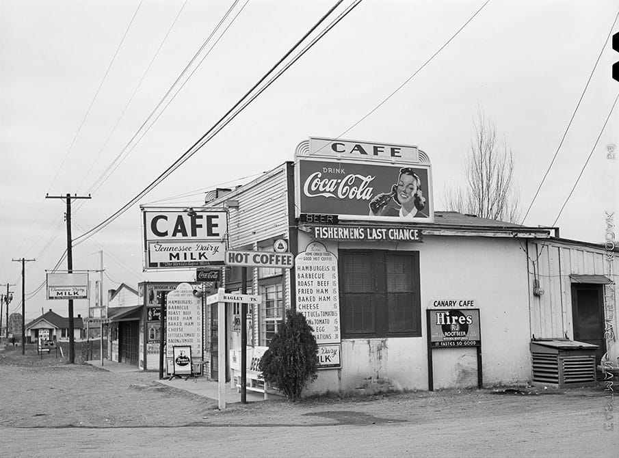
The Canary Cafe stood at the intersection of Bagley and W. Davis in Arcadia Park, which had not yet been annexed to Dallas. Tennessee Dairy, advertised near the café's entrance, was a local competitor to Metzger's as shown on the next location in the tour. Hires root beer, first introduced in 1876, was phased out entirely by the mid-2010s. In 1942, a Canary Cafe hamburger retailed for 10¢.
The Canary Cafe off Bagley Street, Arcadia Park
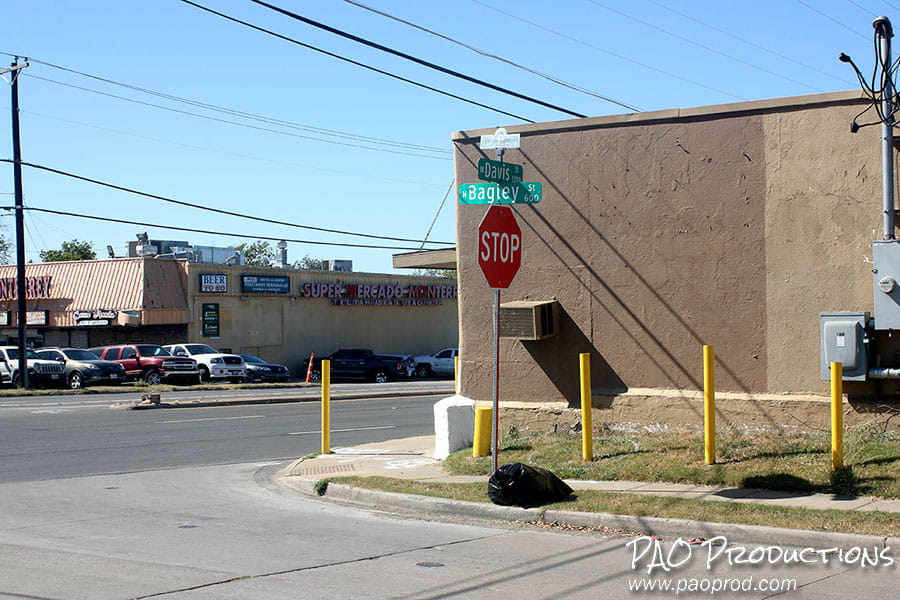
Facing west at the intersection of W. Davis and Bagley in late 2025, when the Supermercado Monterrey stands as a busy attraction on the other side of the street.
W. Davis St (E. Main St) and N. Bagley in 2025
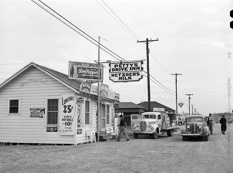
Petty's Drive Inn, offering 25¢ lunches and 10¢ hot dogs, flanked the Canary on the other side of Bagley Street. Metzger's Milk was a locally based dairy outfit known for its home delivery, ultimately sold to Borden in the 1980s.
Petty's Drive Inn at Bagley and W. Davis
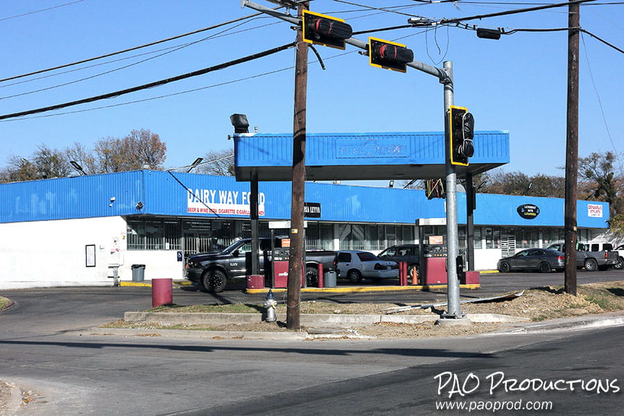
Today, a gas station/convenience store occupies the old Petty's site.
Dairy Way Food and gas station
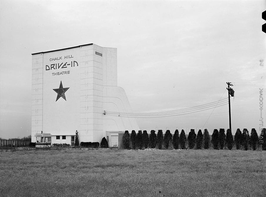
The 12.5 acre, 408 car capacity Chalk Hill Drive-In Theatre opened in July 1941 with The Invisible Woman as its first feature. The theater remained in operation until 1973 and was demolished the following year.
The Chalk Hill Drive-In at 4501 W. Davis Street, Dallas
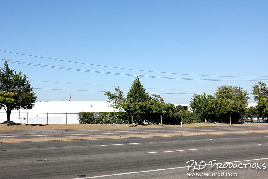
Hardie's Fresh Foods and Taylor Farms occupy the former theater site today.
The former drive-in site as viewed from Mount St. Michael Catholic School
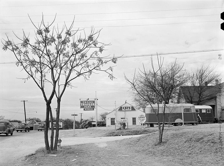
The Texas Trailer Park resided at the northwest corner of Fort Worth Avenue and N. Montclair, sporting not just trailer spaces but a "fine food" café and nearby Lee's Garage.
Texas Trailer Park at 1607 Fort Worth Avenue, Dallas
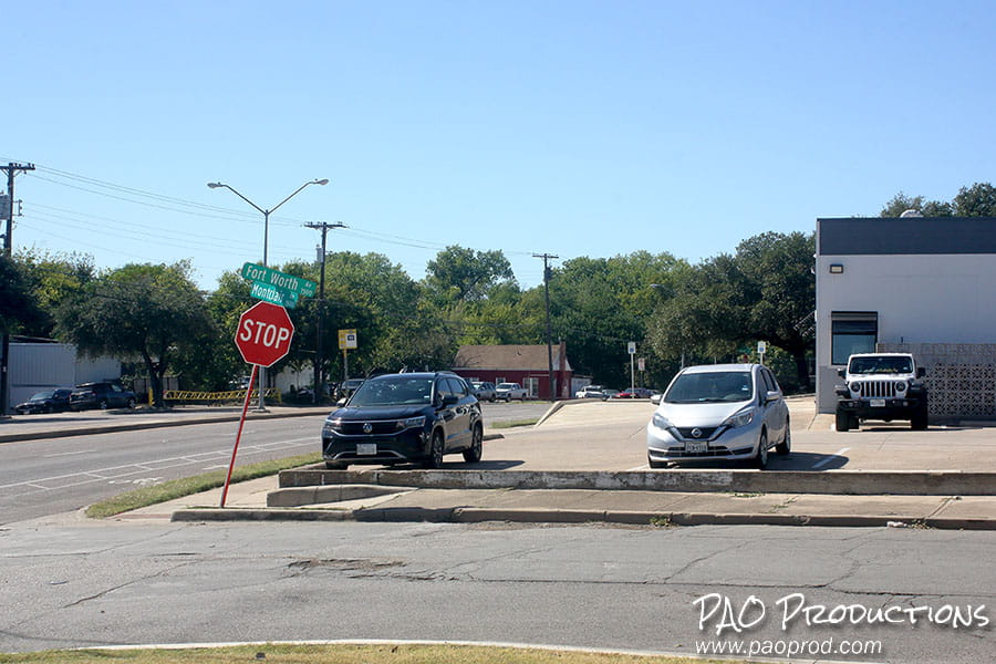
A White Rhino Coffee & Roastery (and adjoining parking lot) occupies the old trailer park site as of late 2025.
Facing the one-time trailer park site in late 2025
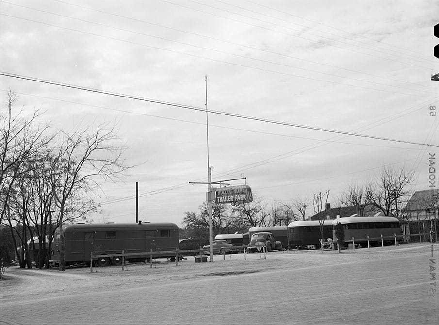
The Rolling Home Trailer Park provided living space for residents at 1526 Fort Worth Avenue. By 1950, the trailer park had been replaced by the Kliff Motor Truck Company.
Rolling Home Trailer Park at 1526 Fort Worth Avenue, Dallas
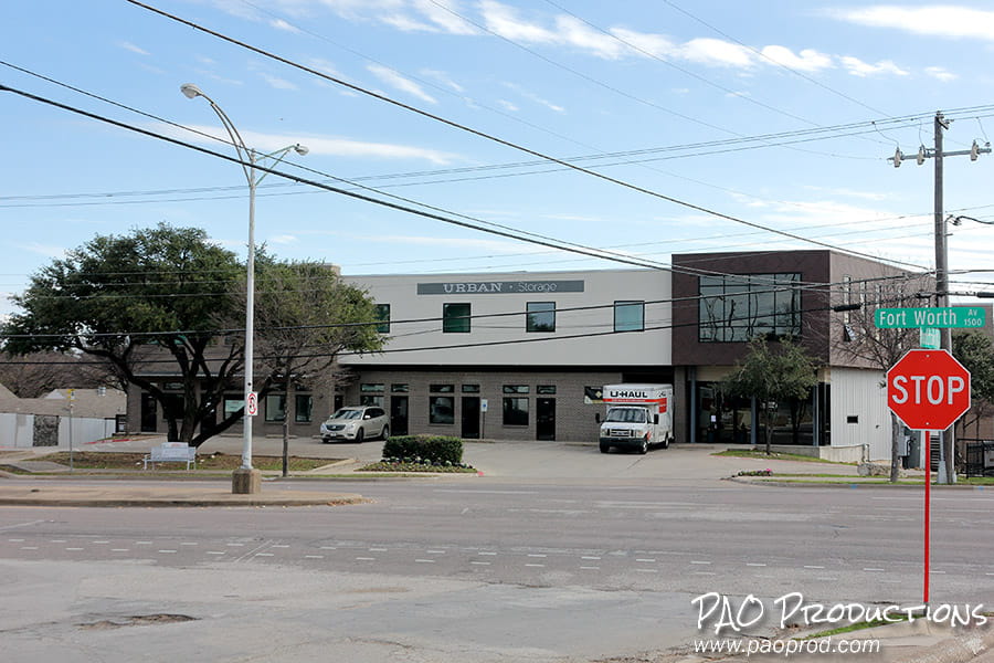
Today, a family owned and operated storage facility stands on the former trailer park site.
A3 Urban Storage at 1526 Fort Worth Avenue
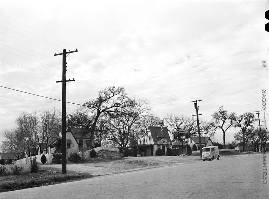
The forty-unit West Commerce Tourist Lodge/Blue Top Tourist Courts was one of a number of such lodges built to accommodate the rush of tourists expected for the 1936 Centennial Exposition.
The West Commerce Tourist Lodge, Dallas
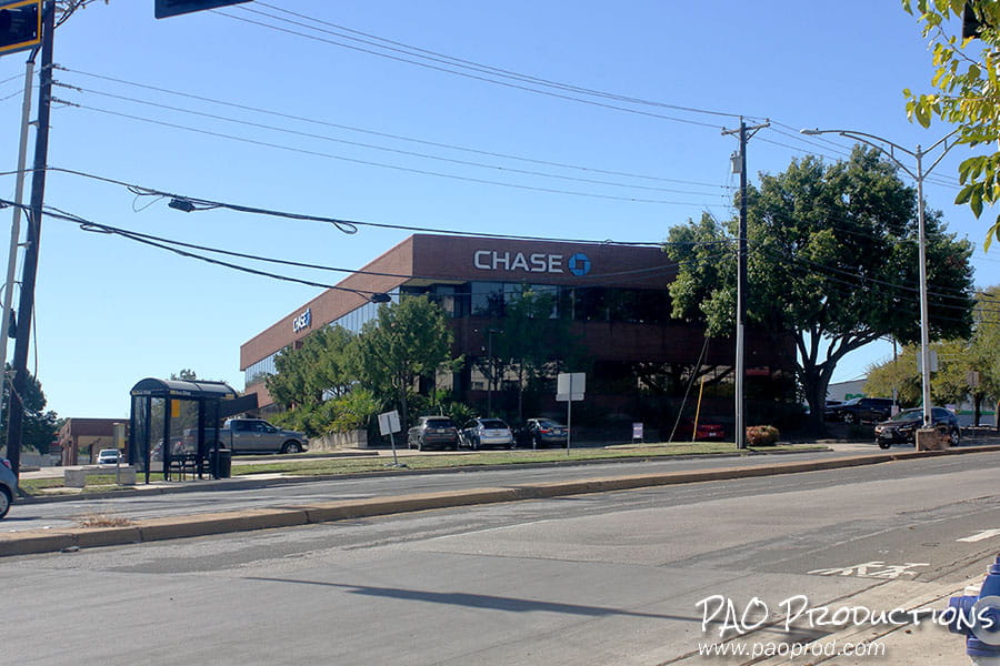
A Chase Bank now sits near the location of the old tourist lodge on Fort Worth Avenue.
Chase Bank on Fort Worth Avenue, 2025
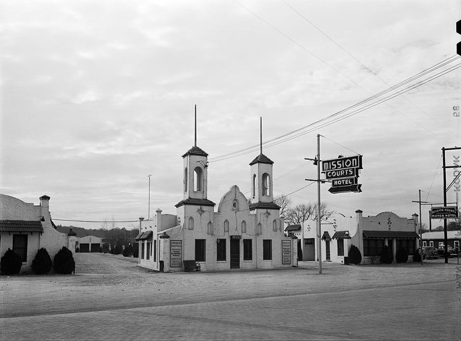
The Mission Courts at Fort Worth Avenue and W. Commerce were another forty-unit construction project whose impetus was the 1936 Centennial. As of June 2014, the old buildings were still standing, abandoned.
The Mission Courts Hotel at 500 (now 555) Fort Worth Avenue
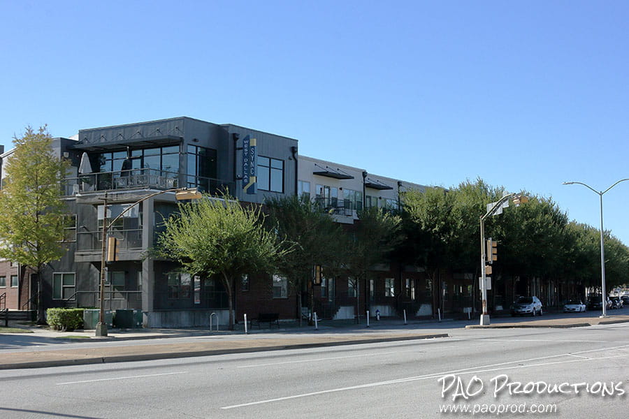
In 2025, the SYNC West Dallas apartment complex entices potential tenants along this increasingly gentrified stretch of the old highway.
The "SYNC West Dallas" apartment complex in 2025
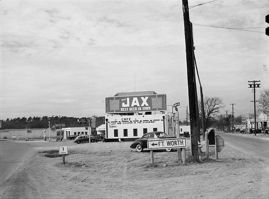
On the other side of the highway, directly across from the Mission Courts, lay a fork in the road where the highway split off from Commerce Street. Adjacent to the turnaround sat Tommie's Calf Stand (later the Semos family restaurant), its roof adorned with a giant billboard advertising Louisiana-based Jax Beer as the "best beer in town." Farther off in the distance were the Sky-Vu dance club, a Gulf Oil filling station, and a Safeway grocery store.
The Fort Worth Avenue/Commerce Street fork in 1942
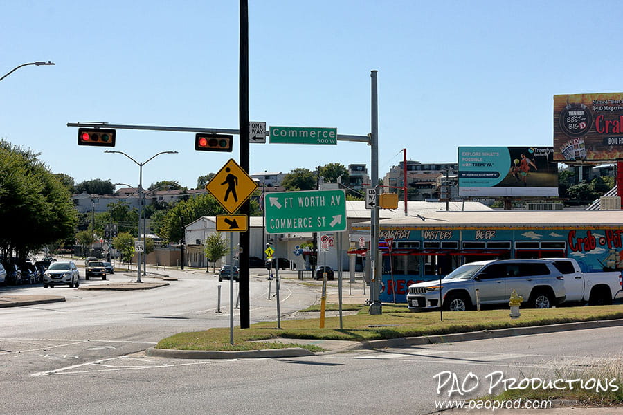
The fork still exists today, with the Crab Pot (as of late 2025) now in place of the long gone Semos family restaurant, and industrial property taking up the one-time Safeway location. The dance club and filling station are long gone.
The Fort Worth Avenue/Commerce Street fork in late 2025
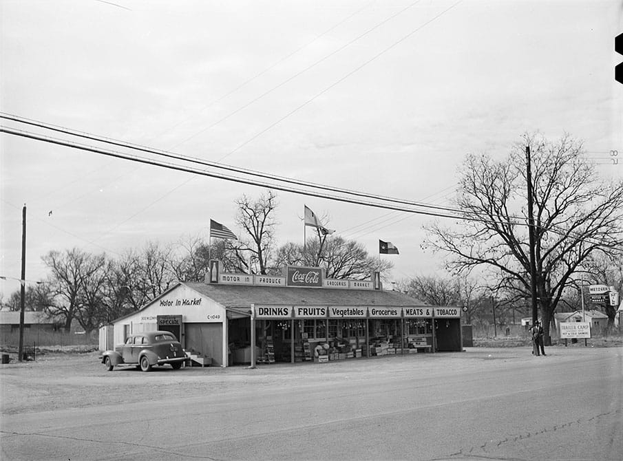
The Motor Inn Market at W. Commerce Street and Hardwick offered meat, produce, and grocery items alongside an adjacent "modern trailer camp."
The Motor Inn Market at 300 (now 266) W. Commerce Street, Dallas
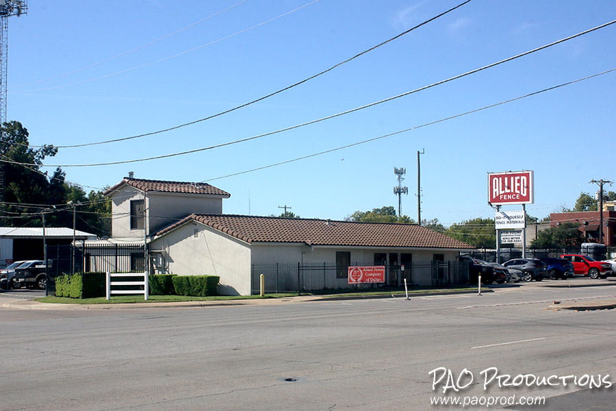
Today, the Allied Fence company occupies the site once owned by the Motor Inn Market, and the adjacent trailer park is long gone.
Allied Fence Company in 2025
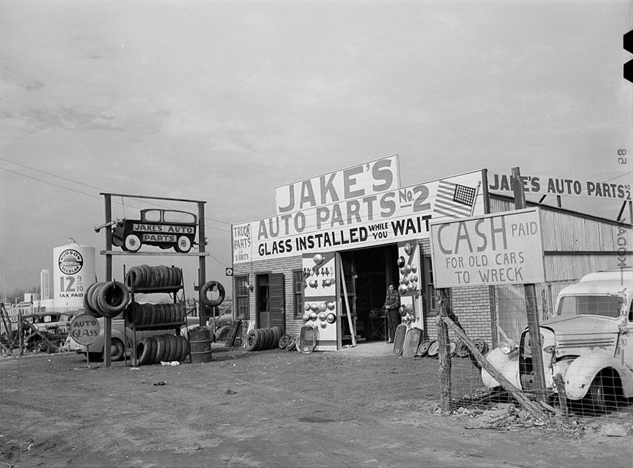
Across the street from the Motor Inn Market and Trailer Park stood Jake's Auto Parts No. 2, which offered cash in exchange for old vehicles. Location #1 was situated at what is currently a parking lot in Deep Ellum.
Jake's Auto Parts No. 2 at 311 (now 255) W Commerce Street, Dallas
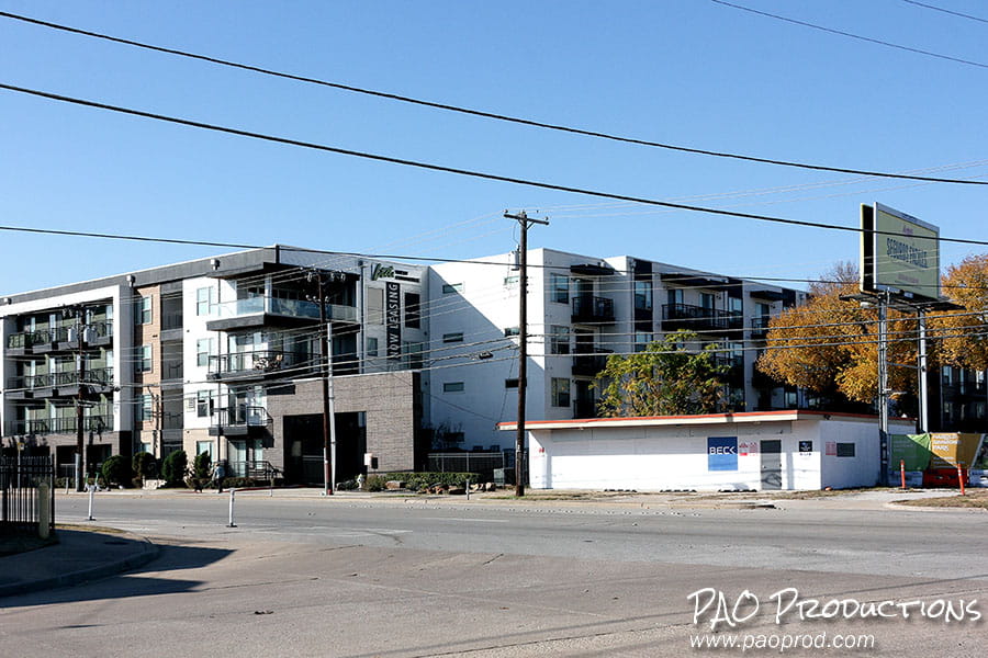
As of late 2025, a vacant building sits at 255 W Commerce, constructed in 1954 as a drive-in grocery, later the home of a transmission exchange, and now an empty shell situated next door to another of gentrification-happy Dallas's newer apartment complexes. Each structure shares a portion of the space once taken up by Jake's #2.
Vacant building at 255 W Commerce Street in 2025, next door to the LTD West Commerce apartment complex
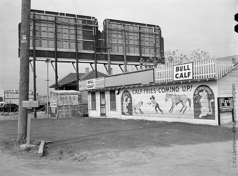
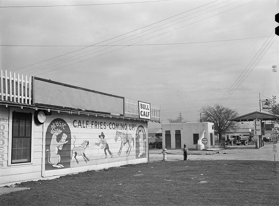
The Bull Calf Stand, two doors down from Jake's Auto Parts, offered barbecued ribs and calf fries on its menu.
The Bull Calf at 301 (now 247) W. Commerce Street, Dallas
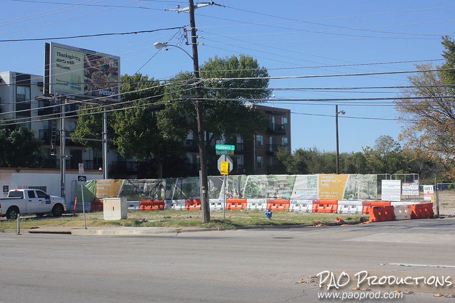
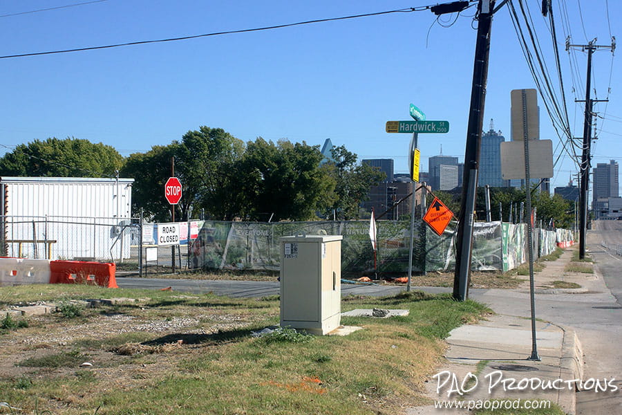
The old Bull Calf restaurant site as of late 2025, currently an empty lot.
Empty lot at W. Commerce and Hardwick in late 2025
Facing west toward downtown from the Bull Calf, at the intersection with Hardwick Street, a lone child stood gazing inquisitively toward the cameraman.
Facing west from the Bull Calf Stand
The view as of late 2025 is decidedly less attractive.
Facing west at the intersection of Commerce and Hardwick in 2025
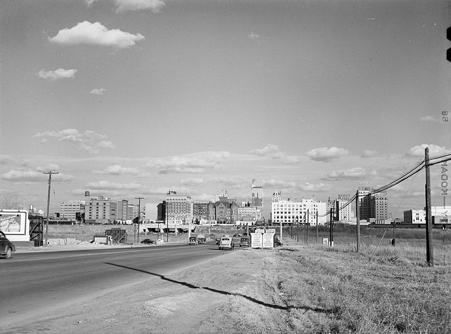
Approaching the Triple Underpass and downtown Dallas in 1942, the city skyline stretched expansively across the horizon. The Sexton building (formerly the Southern Rock Island Plow Co. building and, much later, the Texas School Book Depository building) and the Old Red Courthouse (sans clock tower), loomed recognizably in the distance. Towering triumphantly above all others was the Magnolia Petroleum Building, opened in 1922 and the tallest building in the city at the time.
Approaching downtown Dallas in 1942
Approaching downtown Dallas in 1942
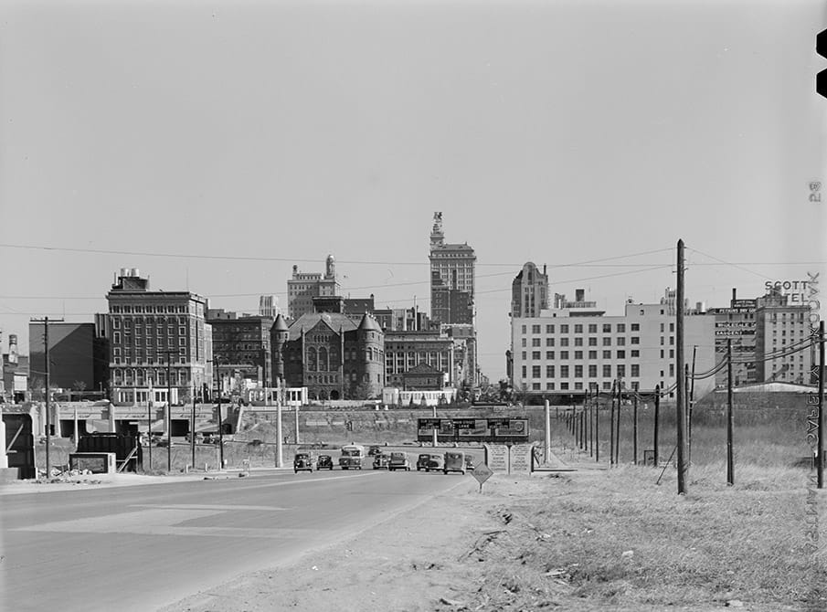
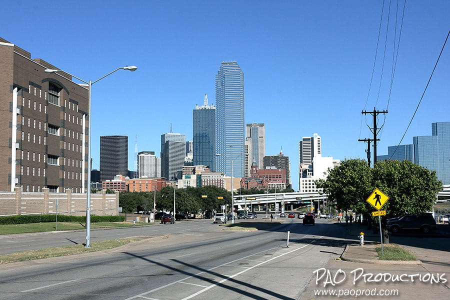
A quarter of the way into the twenty-first century, this stretch of roadway has been significantly transformed, the view now completely dominated by modern high-rise skyscrapers that dwarf anything present in 1942. The Bank of America building, completed in 1985, towers above all at a height of 921 feet. Nevertheless, the old School Book Depository building (officially The Sixth Floor Museum) and the Old Red Courthouse (with clock tower now restored) are still visible as part of the modern Dallas skyline.
Approaching downtown Dallas in late 2025
All historical photos are via the Library of Congress, with photographer acknowledged as Arthur Rothstein, and are in the public domain.
Route map generated using technology from OpenStreetMap.
Special thanks to Gaby Kienitz of the Fort Worth History Center for assistance in attempting to determine Fort Worth's 1942 western boundary line.