The adventures and various works of a photographer, road tripper, former patron of the local arts, aspiring app developer, and late night coffee drinker and conversationalist.
Here is another selection of rare and mostly one-of-a-kind photos of the Dallas-Fort Worth area, drawn from my personal collection of prints, slides, and film negatives.
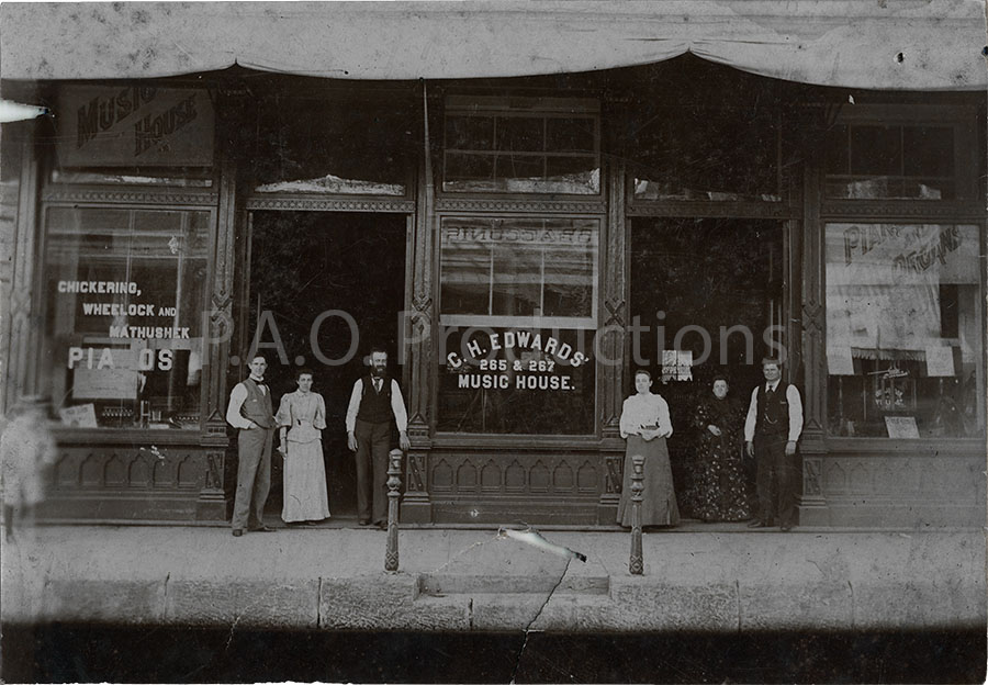
C.H. Edwards' Music House, 1890s
Charles Hodge Edwards moved to Dallas in the 1870s and opened a piano store at 407 Main Street. He set up shop in at least three locations before settling by 1884 at 733-735 Main. This cabinet card photo, most likely from the 1890s, captures that final location, the address having been changed in 1891 to 265-267 Main Street as part of a citywide address renumbering initiative. C.H. Edwards' younger brother, James H. Edwards, is identified at the bottom of the photo as the third from left of the six people pictured. Today, the old site of the music house is occupied by the Westin Hotel/One Main Place.
C.H. Edwards Music House at 265-267 Main Street, 1890s
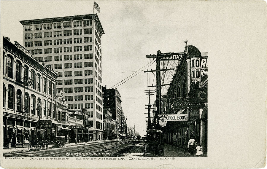
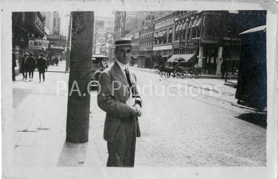
View down Main Street near Akard, circa 1909
This postcard depicts Dallas's Main Street facing east, two blocks east of the 1912 photo which follows below (one block today due to the diminishment of Exchange Pl, known at the time as Scollard Ct). The newly-constructed Praetorian building dominates the skyline, though its reign as Dallas's tallest building would be a short one. Note the Imperial Bar building at its left, which survives in 2026 as the Uno Mas Tex Mex restaurant.
Main Street at Akard, circa 1909
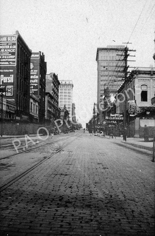
Looking east on Main Street, 1912
This snapshot records the view at the intersection of Dallas's Main and Field Streets in June of 1912, facing east. The tall building on the right is the Southwestern Life Insurance Building, which was demolished in 1972. The Praetorian building, demolished in 2013, can be seen as the light-colored building just left of center. Today, Pegasus Plaza sits on the former Southwestern Life location, and the Praetorian building has been replaced by the "Giant Eyeball." This scene, captured on June 1, 1912, clearly shows not only the streetcar line that once extended along Main Street, but also the surface paving that existed at the time.
Looking east on Main Street, June 1912
Bill Hatch in front of the Southland Hotel, 1912
We see here a street view of old Dallas, taken in 1912 in front of the long gone Southland Hotel. The Southland was an eight-story structure located at 1200 Main Street downtown, and spanned a full block from Main to Commerce at Murphy Street. The original Southland Hotel was not the same as the Southland Center (later the Adam's Mark Hotel and now the Sheraton), which was erected in 1959 on Olive Street. Today the Metropolitan, a high-rise condominum complex, occupies the former site of the Southland, and Murphy Street survives only as a crosswalk and glorified walkway.
I have no information on Bill Hatch other than his appearance in this photo, and his identification in handwriting on the back.
Bill Hatch in front of the Southland Hotel, 1912
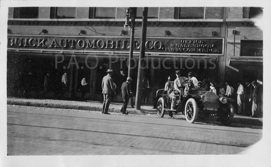
Buick Automobile Co. building at Commerce and Poydras, 1913
This photo of the long, long gone Buick Automobile Company building at the corner of Dallas's Commerce and Poydras Streets dates to 1913. Note that the signage still gives the building's pre-1911 street address of 238-40 Commerce Street. The 1911 renumbering of Dallas city streets changed this address to 1008-10 Commerce, near where the McDonald's stands today.
Buick Automobile Company in downtown Dallas, 1913
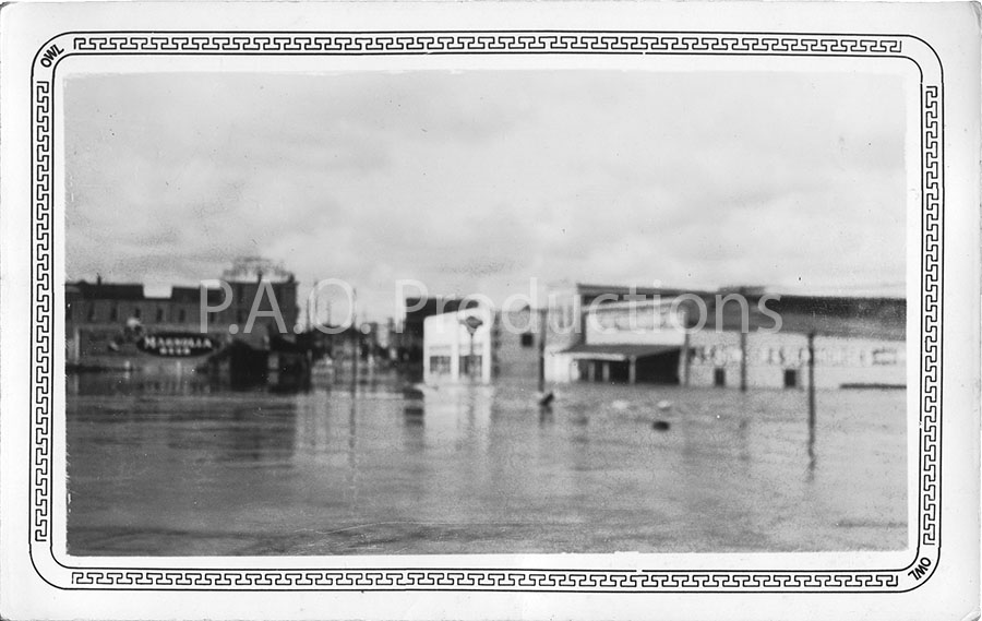
Trinity River flood waters, unknown date
The Trinity River has flooded many times since the founding of Dallas, and prior to its relocation (and straightening) in 1928, these floods would inevitably submerge the downtown and Oak Cliff areas of the city in water. This unique snapshot depicts one such occurrence in the area near where the Dallas Farmers' Market is now located.
Trinity River flood waters, pre-1928
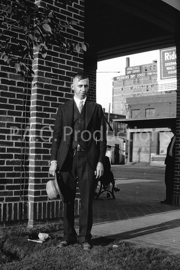
St. Louis Southwestern Railway platform, circa 1920s
This is one of a set of medium format film negatives chronicling a couple's travels around the state sometime during the 1920s. A companion photo to this one shows a shorter woman standing in the same spot, presumably the person taking this photo given its slight upward angle. The location of this photo appears to be the platform adjacent to the St. Louis Southwestern Railway line, which ran along Lamar Street past Young, which is the street shown in the background. The garage on the right is long gone, its location occupied today by a parking lot, and the old Perkins Dry Goods building, demolished in 2001, has given way to a multi-story parking structure.
St. Louis Southwestern Railway platform, circa 1920s
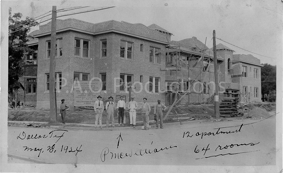
Halborn Terrace Apartments, 1924
The Halborn Terrace apartment complex, located at the corner of Hall and Wellborn Streets in Dallas, was a building of twelve units designed in a Spanish architecture style. An August 1924 newspaper ad characterized the units as "situated in the most exclusive section of Oak Lawn and... handsomely furnished." This photo from May of that year captures the development during the late stages of construction, a sign boasting of the Murphy beds with which each unit was to be outfitted. The Centrum business center and residences occupy this location today.
Halborn Terrace Apartments under construction, 1924
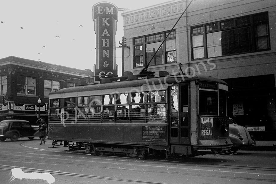
E.M. Kahn & Co. building, 1939
Emanuel Meyer Kahn's apparel store on the southeast corner of Elm and Lamar Streets was a Dallas fixture for over ninety years. It was the city's first air-conditioned retail establishment, and at the time of its sale in 1969, it was the oldest one in Dallas. Today the old Kahn's location makes up part of the large Bank of America complex, situated across the street from Rosa Parks Plaza.
E.M. Kahn & Co. building, 1939
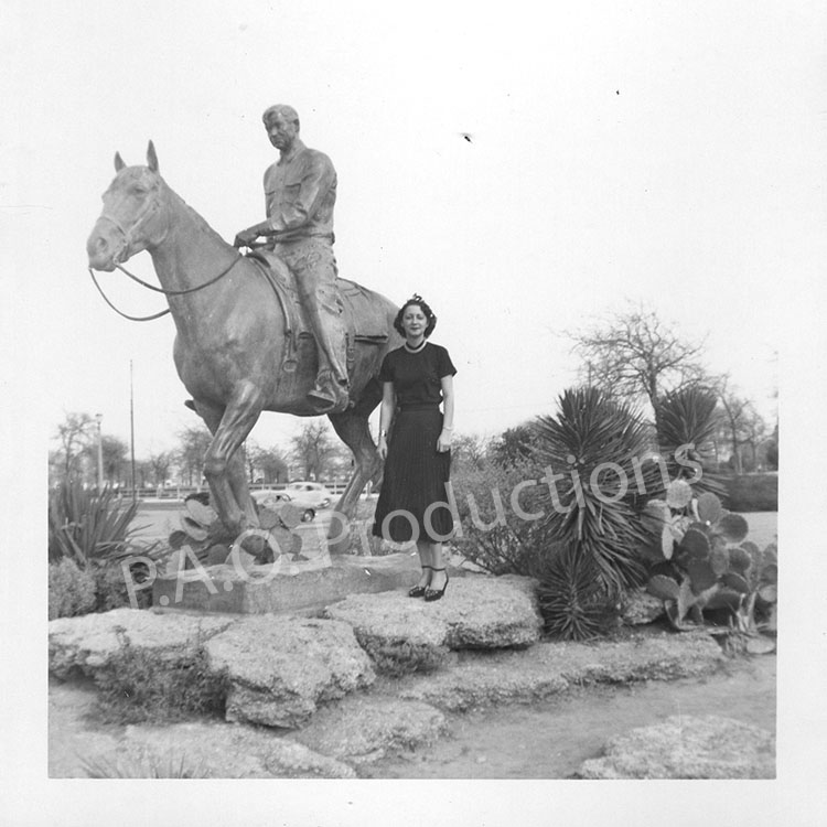
Will Rogers statue, circa 1950s
The Will Rogers statue outside Fort Worth's Memorial Center has long been a popular site for photos and selfies. I don't have a date for this particular image, but it likely hails from sometime in the 1950s.
Will Rogers Statue in Fort Worth
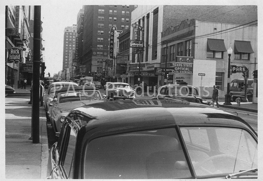
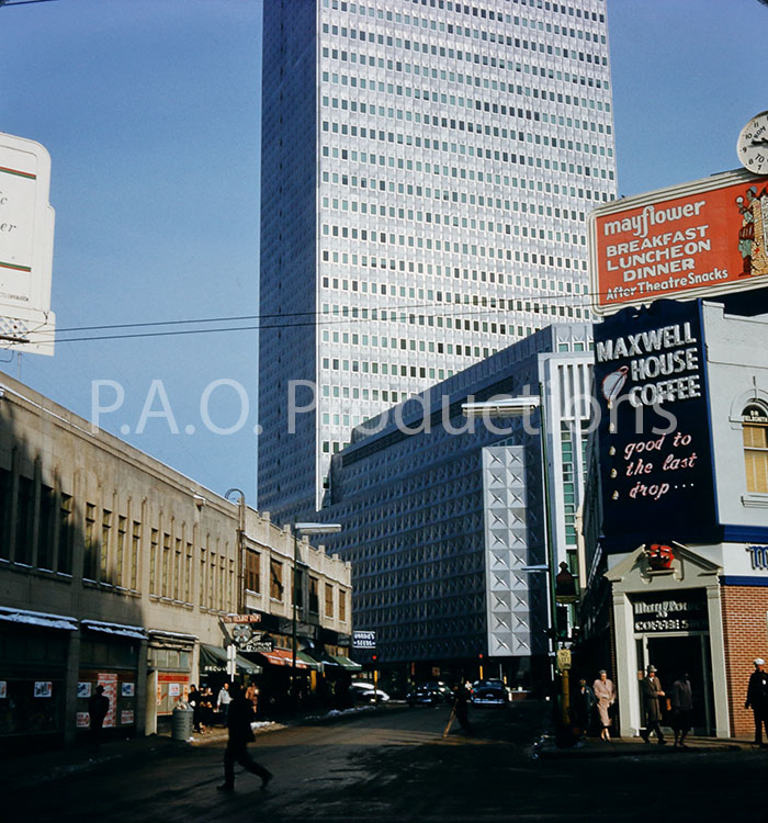
Commerce at Field Street, 1952
This view of Commerce at S. Field Street in Dallas, facing east, is said to date to 1952. The area occupied by Texas State Optical and the Hertz Rent-A-Car is today taken up by the Exchange Food Hall, one of the latest in an ever-growing number of food and retail establishments that have decided they're too sophisticated to accept cash as payment. The Baker Hotel and Southland Life buildings in the distance have long since been replaced by the present-day AT&T Headquarters.
View of Commerce at Field Street, 1952
The "triangle," 1950s
The "triangle" was an area of downtown Dallas bounded by Pacific Avenue, Harwood, and Live Oak Streets, extending all the way to Elm. Today, Live Oak Street has its terminus at N. Harwood. This photo comprises one half of a "Stereo Realist" set.
Downtown Dallas's "triangle," 1950s
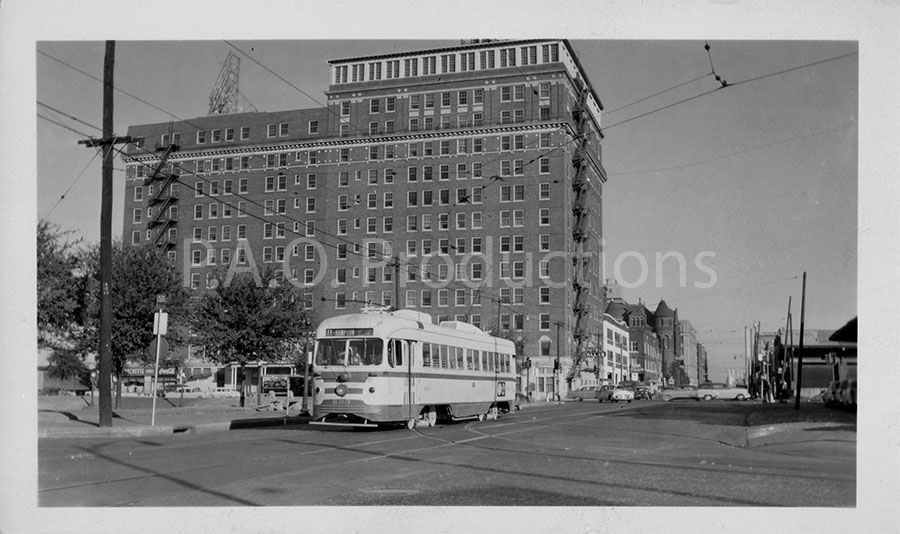
Hotel Dallas, 1955
The Jefferson Hotel, constructed in 1917 when Record Street was still known as Jefferson Street, was renamed to Hotel Dallas in 1953 and demolished in 1975. This photo shows not only the hotel two years after its acquisition by Alsonett Hotels, but also one of the interurbans which once traversed the streets of the city.
Hotel Dallas, 1955
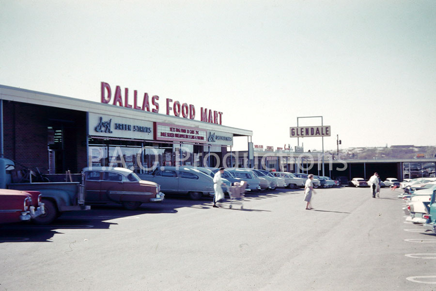
Glendale shopping center, circa 1956
The Glendale Shopping Center opened in Oak Cliff in the mid-1950s, with the Food Mart grocery store following in November 1956. In more recent times, the shopping center hosted a Family Dollar at the former Food Mart site, and it has been a target for potential redevelopment.
Glendale shopping center, 1950s
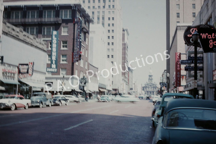
Main Street, 1959
This Kodachrome slide captures a late 1950s view of Fort Worth's Main Street, facing northwest toward the Tarrant County Courthouse.
Fort Worth's Main Street, 1959
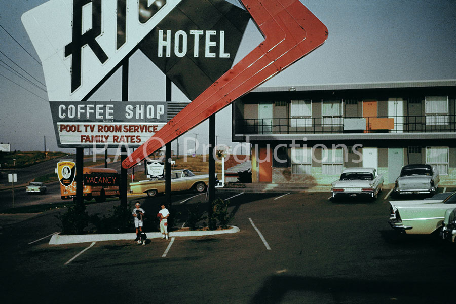
Rio Motor Hotel, 1959
Fort Worth's 125-room Rio Motor Hotel opened for business in 1959 at 6600 Camp Bowie Blvd., then part of U.S. Highway 80. The Rio originally offered twenty-four hour service and a private club. Taco Cabana opened its first Tarrant County location on the old site in 1988.
Rio Motor Hotel, 1959
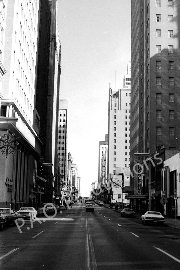
Main Street at Exchange Place, 1960s
This 35mm film negative captures the view facing east on Dallas's Main Street near Exchange Place (historically known as Scollard Ct), near the Adolphus Hotel.
Main at Exchange facing east, 1960s
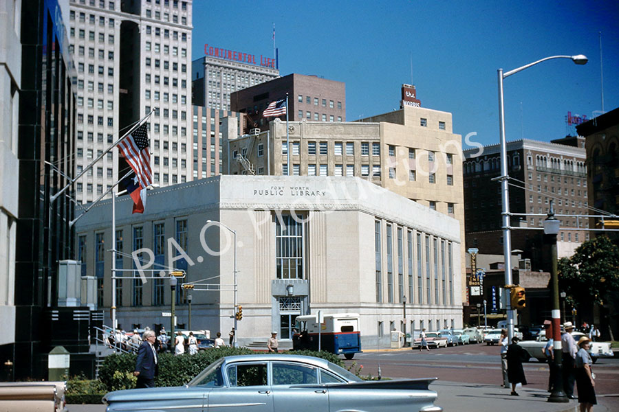
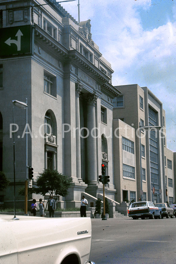
Fort Worth Public Library, 1960
The Art Deco-inspired Fort Worth Public Library building at Ninth and Throckmorton Streets opened in 1938, replacing the earlier Carnegie Public Library built in 1901 at the same location. The 1938 building shown here was itself replaced in 1978 by a new central library building on Taylor Street, and it was demolished in 1990 in favor of a parking lot.
Fort Worth central library building, 1960
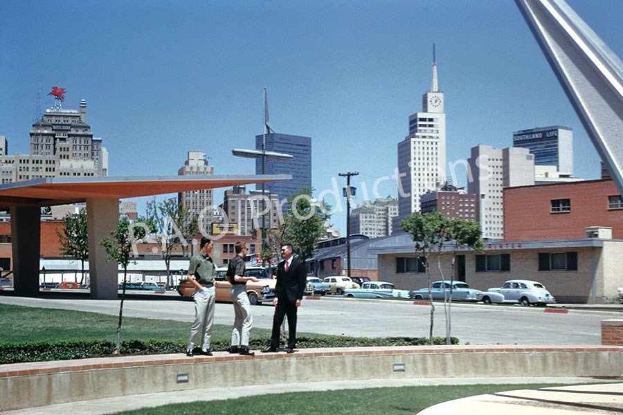
View from Veterans Memorial Garden, 1960
This 1960 Kodachrome slide presents the view from the Veterans Memorial Garden at the corner of Dallas's Akard and Canton Streets, adjacent to what is today The Black Academy of Arts and Letters. The orientation is facing toward the north, toward where the current Dallas City Hall building stands, with the Dallas Memorial Auditorium just out of frame to the west. The 11.8 acre City Hall complex at 1500 Marilla Street, completed in 1978, completely transformed the look of this area.
View from Veterans Memorial Garden, 1960
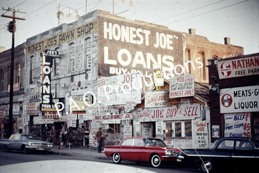
Honest Joe's pawn shop, 1964
"Honest Joe" Rubin Goldstein's pawn shop was a fixture in Deep Ellum for decades. Today the original building survives as Urban Paws, a dog boarding and daycare facility. The story of Honest Joe's is worth a read for anyone interested in the history of the Ellum district.
Honest Joe's pawn shop, 1964
Kennedy assassination site, 1964
The infamous assassination site is seen here no more than four months after the event (the date stamped into the slide's cardboard mount is March 1964). This particular view was reconstructed by Oliver Stone's crew for his 1991 film JFK. While there are no shortage of photos, both period and contemporary, of this stretch of Elm Street, this one appeals to my inner road geek because it shows the original, pre-Interstate U.S. highway shields.
Kennedy assassination site, 1964
Akard Street near Marilla, 1964
The view here is looking north at the intersection of Akard and (the now gone) Masonic Street in downtown Dallas, prior to the construction of the present-day City Hall complex. The old Dixie Grill restaurant is visible at 525 S. Akard at the extreme left, and the National (formerly the First National Bank Tower), which opened for business in 1965, can be seen under construction as part of the skyline.
View of Akard Street near Marilla in Dallas, 1964
Jennings Avenue, 1964
The view here is from Jennings Avenue in Fort Worth, facing north toward W 10th Street. The red building at 902 Jennings Ave. was the home of the housing standards offices and the Texas Employment Commision until both were moved to Texas Street. The 902 Jennings building and the strip of businesses on the west side of the roadway were demolished, their places taken by the current municipal building and downtown public library.
Jennings Avenue in Fort Worth, 1964
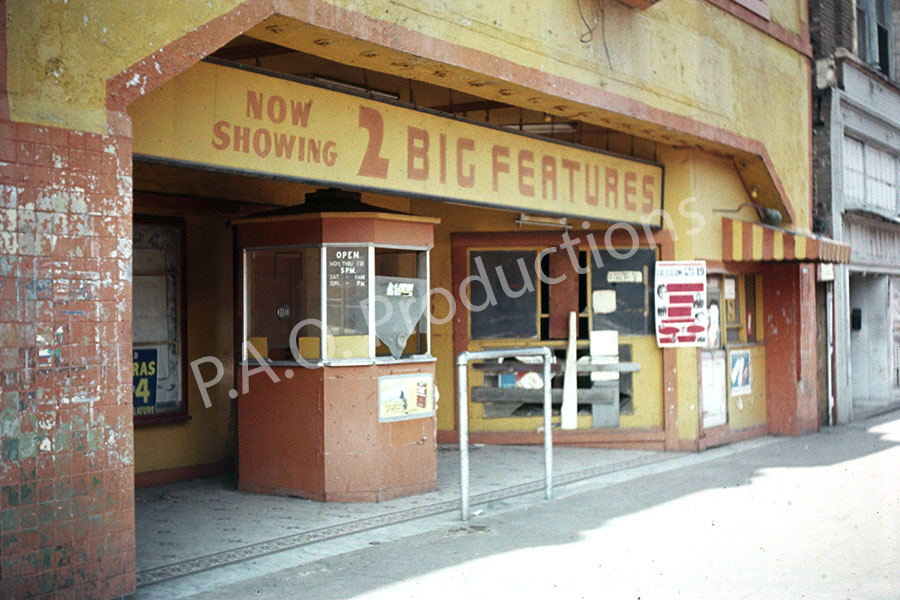
Ideal Movie Theatre façade, Fort Worth, 1965
Located at 1408-1410 Main Street, the Ideal Theatre opened in 1913 as the New Queen Theatre before being rechristened the Ideal Theatre more than a decade later and eventually closing down in 1960. This block, along with the entire stretch of Main Street between 9th and W. Lancaster Avenue, were cleared to make way for the Fort Worth Convention Center and the Water Gardens.
Ideal Movie Theatre façade, 1965
Dallas City Hall, 1967
The Dallas Municipal Building at 106 S. Harwood functioned as the city's fourth, and longest-serving, City Hall until 1978, when local government relocated to the current location at 1500 Marilla Street. This vintage Ektachrome slide captures the building as it neared its fifty-third year of use.
Dallas City Hall, 1967
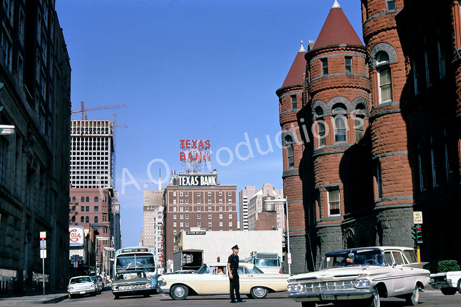
Main Street at Houston Street in Dallas, 1967
The Texas Bank building, demolished in 1982 to make way for a parking garage, can be clearly scene in a famous photo of the John F. Kennedy motorcade taken shortly before his assassination four years earlier. The vantage point of this 1967 Kodachrome slide is facing that motorcade route from the opposite direction.
Main and Houston Streets facing east, 1967
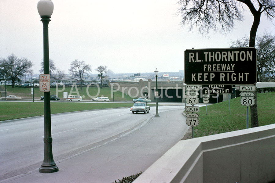
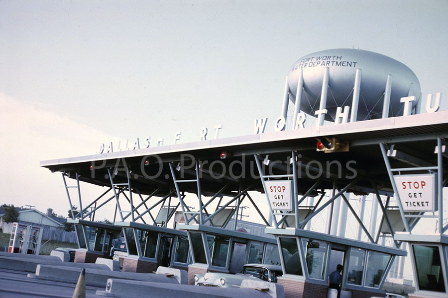
Dallas-Fort Worth Turnpike toll plaza, 1968
The Dallas-Fort Worth Turnpike opened to traffic on August 27, 1957, serving as the fastest automotive connection between the two cities and reducing travel time between them by thirty minutes compared to the then-existing U.S. Highway 80. Initial cost for the complete trip was fifty cents. The tolls were removed in late 1977, and the entire stretch of roadway was incorporated into the Eisenhower Interstate Highway system as today's Interstate 30.
Dallas-Fort Worth Turnpike toll plaza, 1968
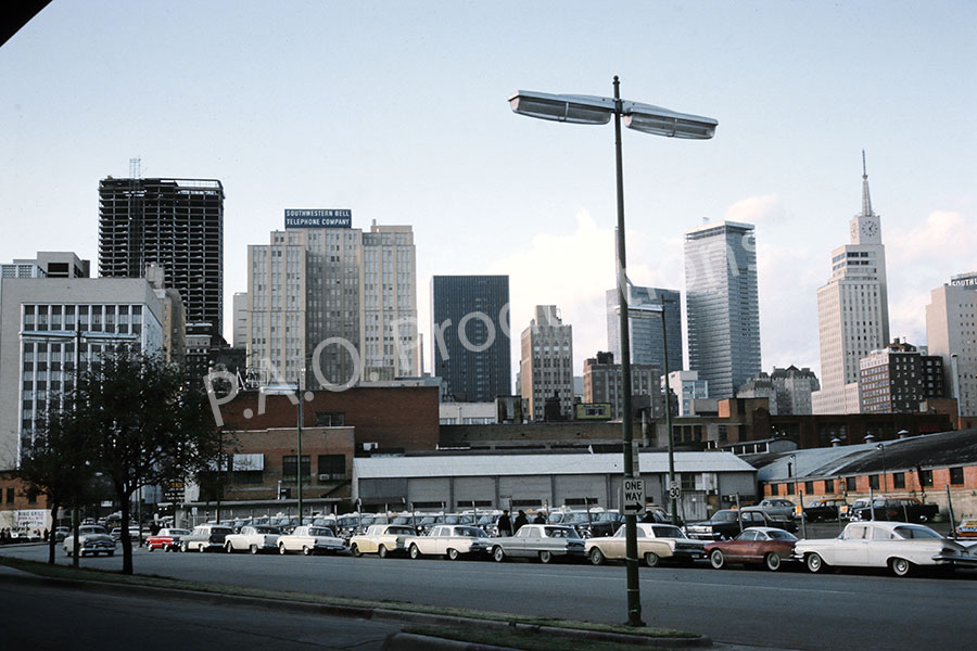
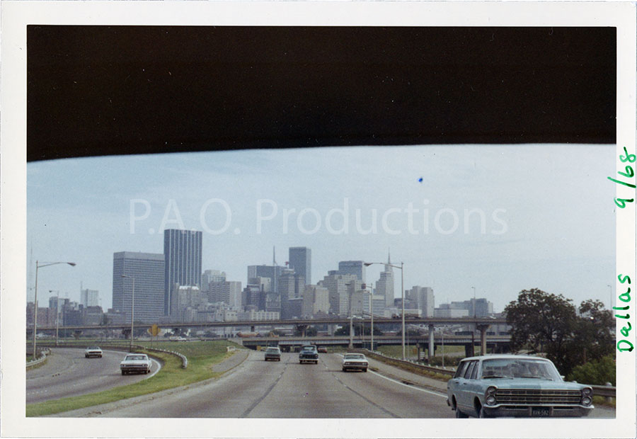
Heading eastbound out of Dallas, 1968
This photo was taken through the rear windshield of car departing downtown Dallas on U.S. Highway 67/80 (present-day Interstate 30).
Departing Dallas, 1968
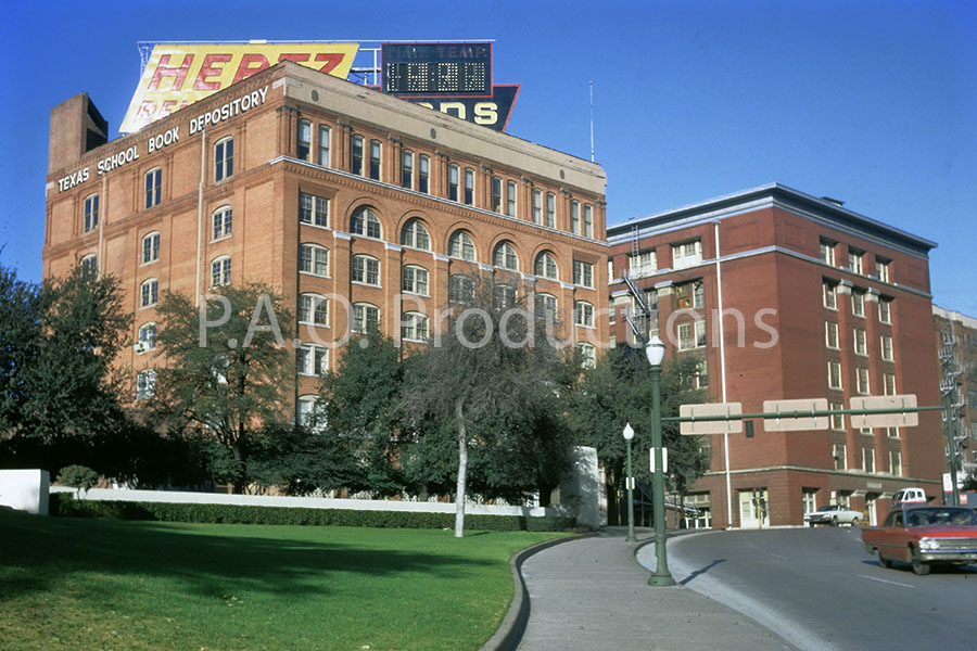
Texas School Book Depository Building, 1969
Photos of the area surrounding the Kennedy assassination spot are so common as to be of relatively little interest to me, but on occasion one surfaces that has some appeal. The view as seen in this 1969 Kodachrome slide, facing toward the building from the Grassy Knoll, is iconic, and, unlike the same view from this vantage point today, is largely unobscured by trees.
Texas School Book Depository Building as seen from the Grassy Knoll, 1969
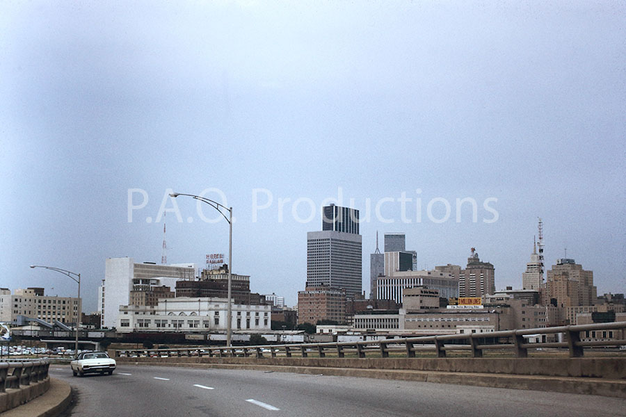
Entering downtown Dallas from Oak Cliff, 1971
This 1971 Kodachrome slide captures the view entering downtown Dallas from Oak Cliff via the Jefferson Blvd. viaduct. Today, this cityscape has been ruined by the overbearing presence of the Omni Hotel.
Entering downtown Dallas via the Jefferson Blvd. viaduct, 1971
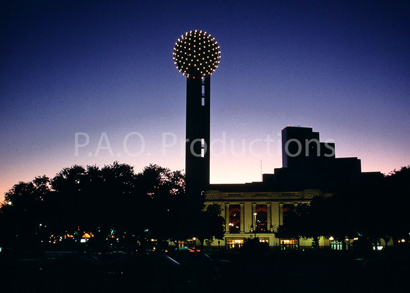
Reunion Tower, 1980
This Kodachrome image of Dallas's Reunion Tower ascending into the dusk dates to 1980, two years after the tower's completion and opening to the public.
Reunion Tower, 1980
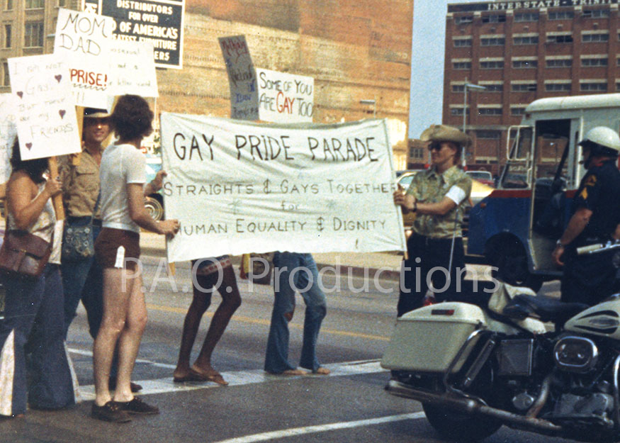
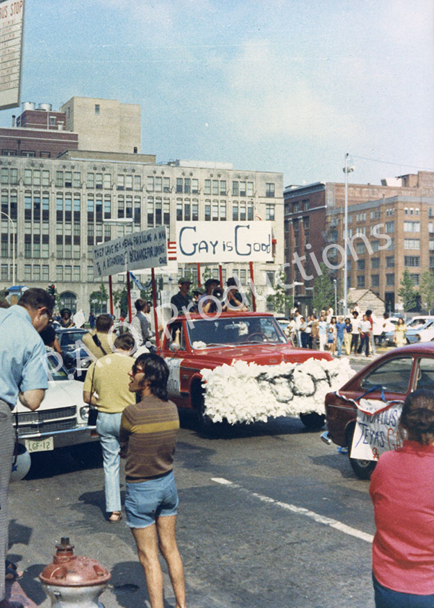
Gay pride parade, early 1980s
Dallas's first gay pride parade took place in 1972, the second following eight years later and kicking off what has since become an annual tradition. These two images depict scenes from the parade's original route on Elm Street downtown and date to 1980 or early in that decade.
Dallas Gay Pride parade, early 1980s
Dallas Gay Pride parade, early 1980s
Billy Bob's marquee, 1983
This 1983 photo captures the view facing north on N. Main near 27th Street, providing a period glimpse of bookings at Billy Bob's two years after its opening inside the Fort Worth Stockyards. Note also the billboard advertising cigarettes, a practice which has been banned in the U.S. since 1998.
Billy Bob's marquee, 1983
Dallas North Tollway construction, 1985
This 1985 slide records two different construction projects near Spring Valley Road in Addison – the Dallas North Tollway, which hadn't yet been fully extended past LBJ Freeway, and the Providence Towers complex alongside it.
Dallas North Tollway construction, 1985
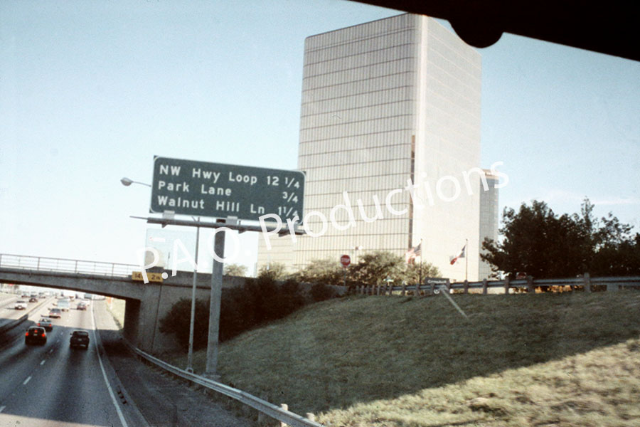
Northbound Central Expressway, 1990
This Seattle FilmWorks slide records Central Expressway in its pre-widened state, just south of Northwest Highway. By the time I got my first driver's license four years later, this stretch of roadway was under heavy construction.
Northbound Central Expressway, 1990
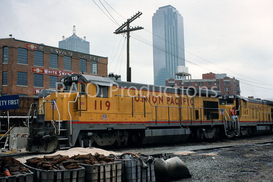
Rail yard and White Swan building, 1990
The White Swan building at 2200 N Lamar, home of the longtime coffee and tea company, was erected in 1926. The railyard area abutting White Swan was, decades later, retooled into Victory Park, and the White Swan building itself was repurposed as the House of Blues in 2007.
Railyard and White Swan building, 1990