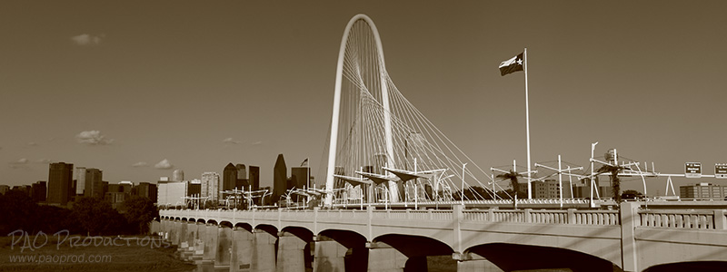
The adventures and various works of a photographer, road tripper, former patron of the local arts, aspiring app developer, and late night coffee drinker and conversationalist.
Here is a collection of rare and mostly one-of-a-kind photos from the Dallas area, most of them from my personal collection. These recall a bygone era in Dallas public transportation, with a focus on showcasing still identifiable areas of the city that have changed significantly since the original images were taken. Vintage streetcar photos can be some of the best representations of what once existed downtown, offering unique glimpses of long-gone city blocks, buildings, and intersections.
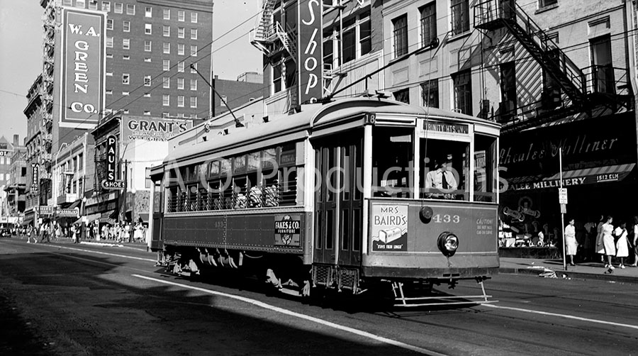
View facing east on Elm Street near Stone Place, circa 1943
This medium format film negative captures a very different view from what is seen today. The Rhealee Milliner on the right side of the picture is now the City Tavern, and the shorter building on the left that housing Paul's Shoes is completely gone, its place now occupied by a parking lot. Today the Giant Eyeball resides in the space next to that parking lot, looking out toward Main Street one block south and marking the farther end of the lot where the old Praetorian building, Dallas' first skyscraper, stood before being demolished in 2013.
Elm Street at Stone, facing east, circa 1943 (Author's collection)
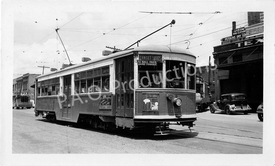
Sunset line, 1947
The Sunset line serviced Oak Cliff, stretching from Pierce Street to Jefferson Boulevard and across the Trinity River into the heart of Downtown Dallas. This photo depicts a Sunset line streetcar in 1947, in the vicinity of the old Perkins Dry Goods building off Jackson Street between Market and Austin.
Sunset line streetcar, 1947 (Author's collection)
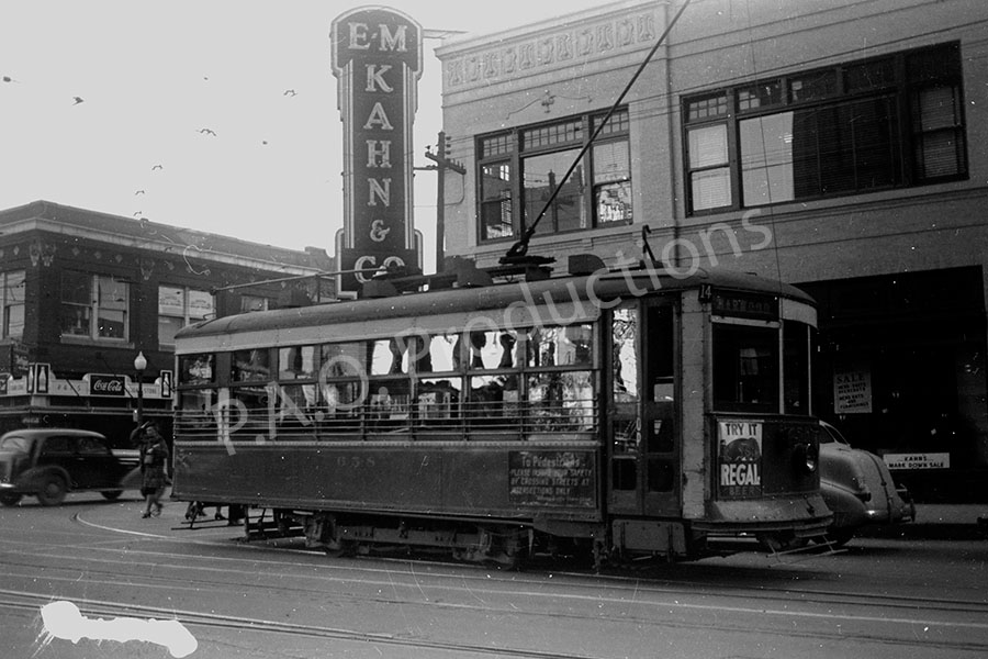
E.M. Kahn & Co. building, 1939
This medium format negative depicts E.M. Kahn & Co.'s building at the southeast corner of Elm and Lamar Streets. Today this corner has been absorbed into Bank of America Plaza, across the street from Rosa Parks Plaza.
E.M. Kahn & Co. building, 1939 (Author's collection)
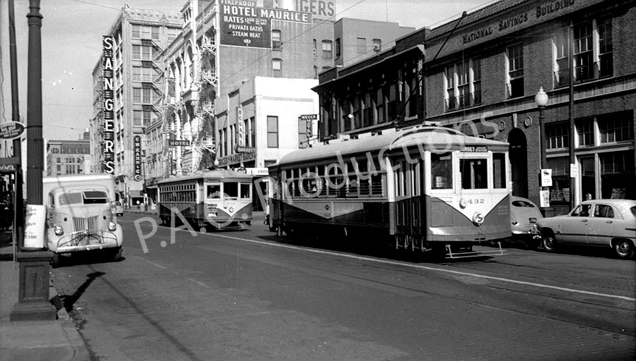
Main Street near Poydras, facing west, 1947
This is a similar view to one held in the UTA Archives. The old Sanger building, built in 1910 and still in use today as part of the El Centro College campus, is visible in the background, as are the long-gone Hotel Maurice and Bogan's Market. The old National Savings Building, also long-gone, is visible at the far right. The Kennedy motorcade traveled down this route in November 1963. Today nearly everything in this photo is gone, replaced by the Bank of America Plaza.
Main Street near Poydras, 1947 (Author's collection)
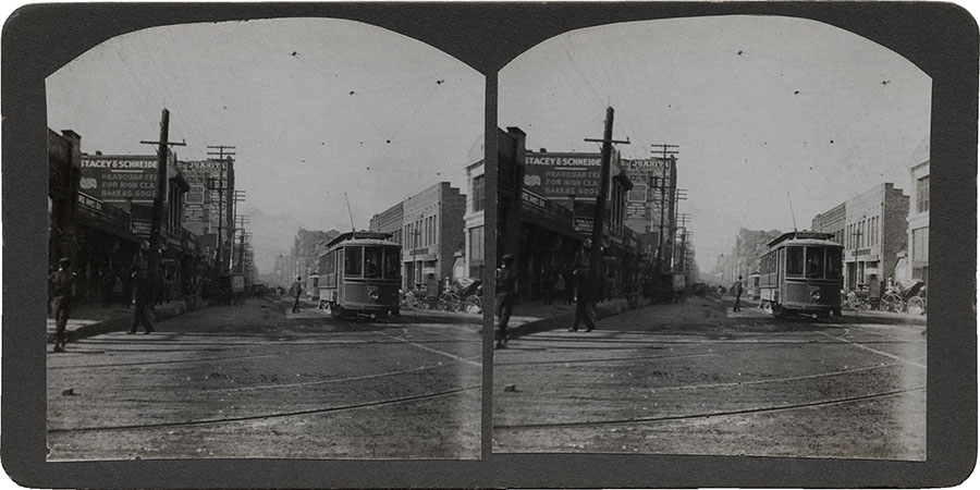
Main Street at Ervay, circa 1900
This circa 1900 stereoview image of Main Street at Ervay, facing west, is one of the earliest Dallas streetcar photos to see commercial publication. The Juanita Building (later the first Deere building) stood on what is today the site of the Joule Hotel. The intersection as pictured in this antique image is completely unrecognizable today.
Main Street at Ervay, circa 1900 (DeGolyer Library, Southern Methodist University)
Northwest corner of Commerce and Austin Streets, 1930s
The view here is facing northwest at the intersection of Commerce and Austin Streets, taken sometime during the 1930s. The old Graham-Brown Shoe Company at 708-714 Main (two blocks from the Old Red Courthouse) is today a parking lot.
Commerce and Austin Streets, 1930s (Author's collection)
Texas Electric Railway, unknown date
The building in the background at left appears to be the Butler Brothers building, which still sits near the present-day location of the current Dallas City Hall at 1500 Marilla Street. This places the likely vantage point of the photographer somewhere near the intersection of Ervay and Wood Streets, facing toward the south.
View near the intersection of Ervay and Wood Streets, unknown date (Author's collection)
Record Street at Young, October 1955
This view facing north on Record Street at Young shows the long-gone Hotel Dallas, originally the Jefferson Hotel, which was demolished in 1975.
Record Street at Young, 1955 (Author's collection)
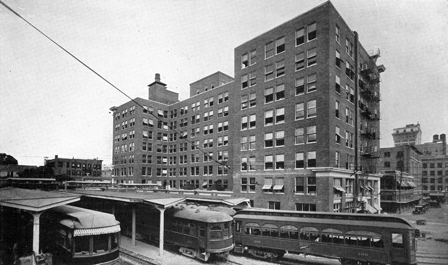
Dallas Interurban building, circa 1925
The Dallas Interurban building was constructed in 1915 at the southeast corner of Jackson and Browder Streets, and it served as a major interurban transportation hub. The building still stands today at 1500 Jackson Street, repurposed as a loft apartment complex. Unfortunately, a large parking garage almost completely obscures the view from the same angle today.
Dallas Interurban Building, circa 1925 (Public domain)
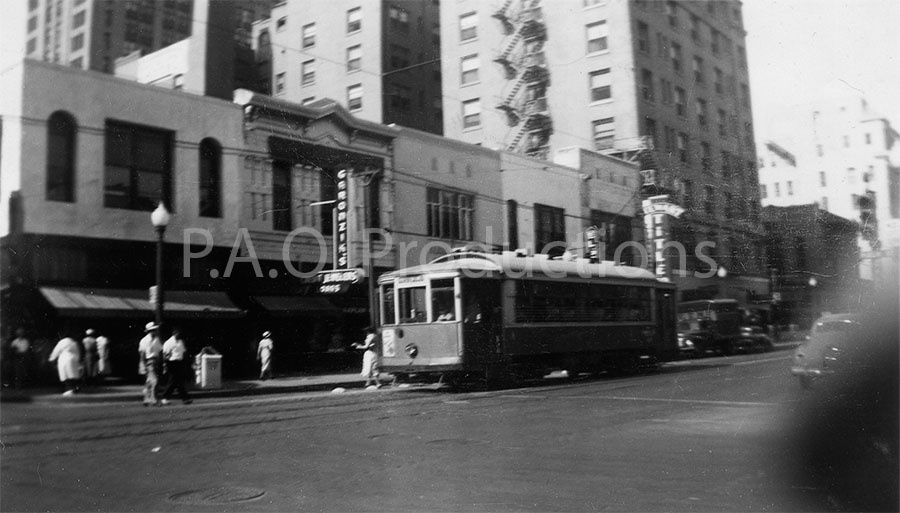
Main Street at Field, facing southwest, circa 1940s
This snapshot of Garonzik's jewelry store and Stewart Title dates to around the mid-1940s or so. Toady this strip is occupied by a parking garage adjoining The Metropolitan, a downtown apartment community.
Main Street at Field, circa 1940s (Author's collection)
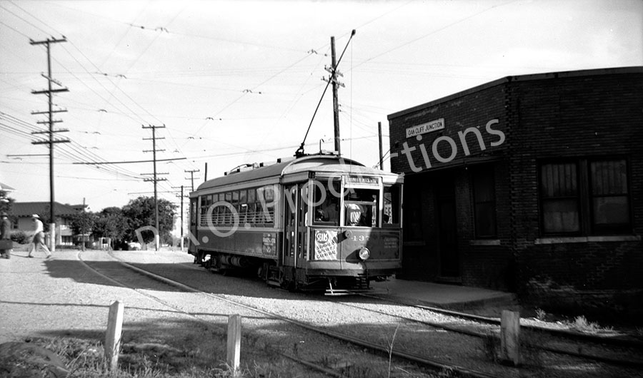
Oak Cliff Junction, 1947
The old Oak Cliff Junction, as shown in this medium format negative from 1947, was situated between Sabine and Comal Streets, very near the route of present-day Interstate 35E. The view is considerably different today.
Oak Cliff Junction, 1947 (Author's collection)
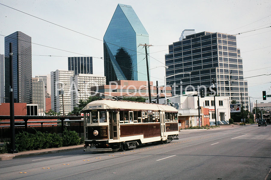
McKinney Avenue Trolley, 1993
The McKinney Avenue Trolley, more commonly known as the M-Line, was Dallas's sole surviving old-style streetcar line, and the only streetcar line still operating in Dallas, until the opening of the Dallas Streetcar in 2015. This Kodachrome slide depicting the M-Line trolley dates to 1993.
McKinney Avenue Trolley, 1993 (Author's collection)
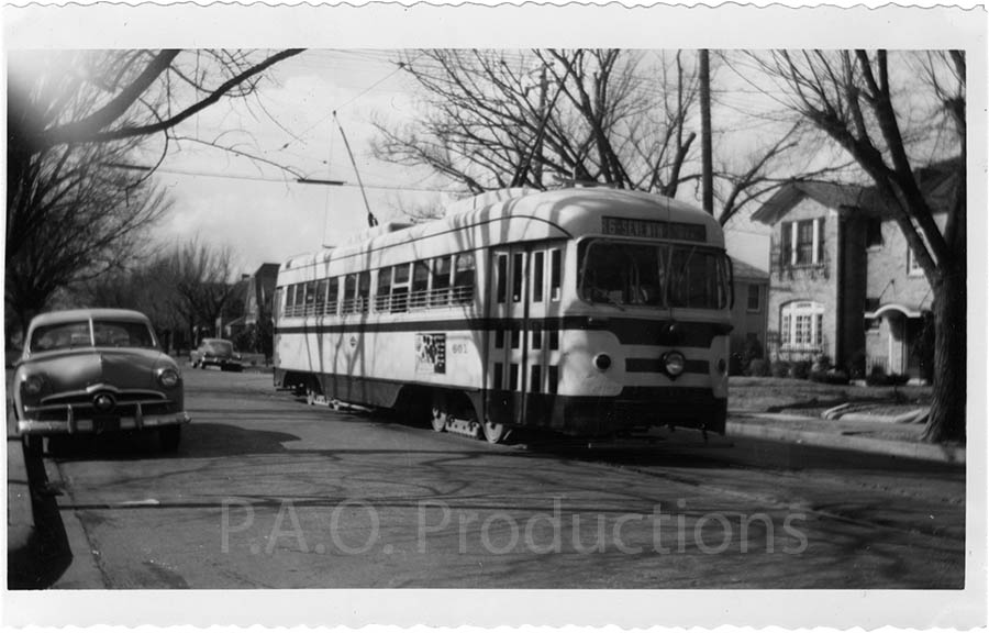
7th Street in Oak Cliff, circa 1950s
The exact date of this photo is unknown, but the design of the streetcar suggests a time frame sometime during the 1950s. The route as indicated on the car is Seventh Street, placing the location of the photo in Oak Cliff.
7th Street in Oak Cliff, circa 1950s (Author's collection)
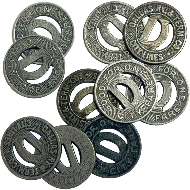
Dallas streetcar transit tokens
I have a collection of ten original transit tokens for the Dallas Ry. & Term Co. streetcar line. The coins measure 10/16 inch (approximately 16.5mm) in diameter and are smaller and lighter than a U.S. dime. Each was good for one fare on the Dallas Ry. & Term Co. streetcar line within the city limits.
Dallas transit tokens (Author's collection)
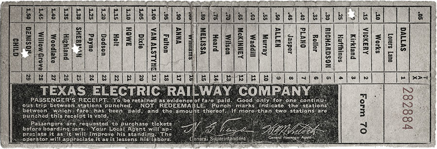
Transit ticket, Texas Electric Railway Company, circa 1940
This vintage transit ticket shows the stops along one of the interurban lines, circa 1940.
Dallas transit ticket, circa 1940 (Author's collection)
"Main Street at Ervay, circa 1900" is reproduced via the DeGolyer Library, Southern Methodist University
"Dallas Interurban building, circa 1925" originally appeared in Making Neighbors of the People of Dallas and Kaufman Counties, and the Towns of Terrell, Forney, Mesquite and Dallas by the Opening of the Texas Interurban Railway, published by the Texas Interurban Railway, 1925, and is in the public domain.
All other photos are from my private collection of images.